Landkreis Gerolzhofen
ehemaliger Landkreis in Bayern Aus Wikipedia, der freien Enzyklopädie
ehemaliger Landkreis in Bayern Aus Wikipedia, der freien Enzyklopädie
Der Landkreis Gerolzhofen im bayerischen Regierungsbezirk Unterfranken wurde 1972 im Zuge der Gebietsreform in Bayern aufgelöst.
| Wappen | Deutschlandkarte | |
|---|---|---|
 |
| |
| Basisdaten (Stand 1972) | ||
| Koordinaten: | 49° 54′ N, 10° 21′ O | |
| Bestandszeitraum: | 1862–1972 | |
| Bundesland: | Bayern | |
| Regierungsbezirk: | Unterfranken | |
| Verwaltungssitz: | Gerolzhofen | |
| Fläche: | 477,42 km2 | |
| Einwohner: | 41.200 (31. Dez. 1971) | |
| Bevölkerungsdichte: | 86 Einwohner je km2 | |
| Kfz-Kennzeichen: | GEO | |
| Kreisschlüssel: | 09 6 38 | |
| Kreisgliederung: | 77 Gemeinden | |
| Adresse der Kreisverwaltung: |
8723 Gerolzhofen | |
| Lage des Landkreises Gerolzhofen in Bayern | ||
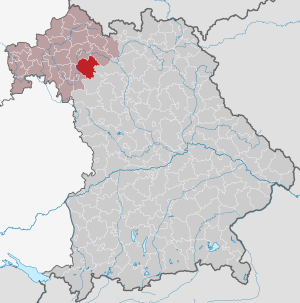 | ||
Der Landkreis grenzte 1972 im Uhrzeigersinn im Nordwesten beginnend an die Landkreise Schweinfurt, Haßfurt, Bamberg, Scheinfeld und Kitzingen.
Das Bezirksamt Gerolzhofen wurde im Jahr 1862 durch den Zusammenschluss der Landgerichte älterer Ordnung Gerolzhofen und Wiesentheid gebildet.[1] Dieses wurde 1872 um einige Gemeinden des aufgelösten Bezirksamts Volkach vergrößert.
Anlässlich der Reform des Zuschnitts der bayerischen Bezirksämter trat das Bezirksamt Gerolzhofen am 1. Januar 1880 die Gemeinde Wiesenbronn an das Bezirksamt Kitzingen ab.
Am 1. Januar 1939 wurde wie sonst überall im Deutschen Reich die Bezeichnung Landkreis eingeführt.[2] So wurde aus dem Bezirksamt der Landkreis Gerolzhofen.
Zwischen 1945 und 1948 amtierte Thomas Keller als Landrat, er war von den amerikanischen Besatzungsbehörden eingesetzt worden. Keller wurde von Josef Eugen Held abgelöst, der bis 1964 amtierte. Von 1964 und 1972 stand Ernst Kastner als Landrat dem Landkreis vor.
Durch die Kreisreform wurde der Landkreis am 1. Juli 1972 aufgelöst:[3][4]
Die ehemalige Kreisstadt Gerolzhofen behielt zunächst eine Anzahl überörtlicher Behörden, die aber mit Ausnahme einer Polizeiinspektion in der Folgezeit alle geschlossen wurden.
Die Gemeinden des Landkreises Gerolzhofen und ihre heutige Zugehörigkeit:[13][14]

Das Gebiet des ehemaligen Landkreises Gerolzhofen wird von der Bundesautobahn 3, den Bundesstraßen 286 und 22, der Bahnstrecke Kitzingen–Schweinfurt, der Mainschleifenbahn und der Bundeswasserstraße Main tangiert.
Am 1. Juli 1956 wurde dem Landkreis bei der Einführung der bis heute gültigen Kfz-Kennzeichen das Unterscheidungszeichen GEO zugewiesen. Es wurde bis zum 28. April 1973 ausgegeben. Seit dem 10. Juli 2013 ist es im Zuge der Kennzeichenliberalisierung wieder im Landkreis Schweinfurt, seit dem 1. April 2014 auch im Landkreis Haßberge erhältlich.
Seamless Wikipedia browsing. On steroids.
Every time you click a link to Wikipedia, Wiktionary or Wikiquote in your browser's search results, it will show the modern Wikiwand interface.
Wikiwand extension is a five stars, simple, with minimum permission required to keep your browsing private, safe and transparent.

