Łabuń (Jurkowice)
wieś w województwie pomorskim Z Wikipedii, wolnej encyklopedii
wieś w województwie pomorskim Z Wikipedii, wolnej encyklopedii
Łabuń (daw. Labun, die Laabe, Labau) – przysiółek wsi Jurkowice w Polsce, położony w województwie pomorskim, w powiecie sztumskim, w gminie Stary Targ[3][4], przy drodze wojewódzkiej nr 515. Przysiółek wchodzi w skład sołectwa Jurkowice.
| przysiółek wsi | |
 | |
| Państwo | |
|---|---|
| Województwo | |
| Powiat | |
| Gmina | |
| Część miejscowości | |
| Liczba ludności (2015) |
38 |
| Strefa numeracyjna |
55 |
| Kod pocztowy |
82-410[1] |
| Tablice rejestracyjne |
GSZ |
| SIMC |
0157345 |
Położenie na mapie gminy Stary Targ  | |
Położenie na mapie Polski  | |
Położenie na mapie województwa pomorskiego 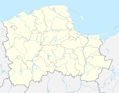 | |
Położenie na mapie powiatu sztumskiego  | |
Miejscowość była wsią włościańską. Od 1466 do 1772 należała do dóbr starostwa sztumskiego i do województwa malborskiego[5]. Na początku XVII wieku, podczas wojen szwedzkich, zaginął jej stary przywilej lokacyjny, podobnie jak dziesięciu innych wsi starostwa. W 1641 starosta sztumski Zygmunt Guldenstern lokował je ponownie na ich prośbę (Łabuń stał na ich czele), powtórnie na prawie chełmińskim. W XIX wieku wieś liczyła stu kilkudziesięciu mieszkańców – nieznacznie więcej wyznania katolickiego niż ewangelickiego. Znajdowała się tam szkoła. Zachowany został układ przestrzenny miejscowości z XIII/XIV wieku w typie ulicówki.
W latach 1945–1975 miejscowość administracyjnie należała do województwa gdańskiego, a w latach 1975–1998 do województwa elbląskiego.
Seamless Wikipedia browsing. On steroids.
Every time you click a link to Wikipedia, Wiktionary or Wikiquote in your browser's search results, it will show the modern Wikiwand interface.
Wikiwand extension is a five stars, simple, with minimum permission required to keep your browsing private, safe and transparent.
