ಚಿತ್ರ:Kazakhstan-CIA_WFB_Map.png
From Wikipedia, the free encyclopedia
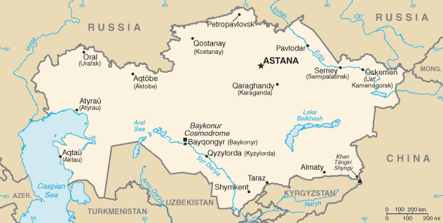
Kazakhstan-CIA_WFB_Map.png (೬೩೨ × ೩೧೯ ಚಿತ್ರಬಿಂದು, ಫೈಲಿನ ಗಾತ್ರ: ೨೧ KB, MIME ಪ್ರಕಾರ: image/png)
ಈ ಫೈಲು ವಿಕಿಮೀಡಿಯ ಕಾಮನ್ಸ್ನಲ್ಲಿ ಇರುವುದು. ಅಲ್ಲಿನ ವಿವರಣೆ ಪುಟವನ್ನೇ ಕೆಳಗೆ ತೋರಿಸಲಾಗಿದೆ. ಕಾಮನ್ಸ್ ಕೃತಿಸ್ವಾಮ್ಯತೆಯಿಂದ ಮುಕ್ತ ಫೈಲುಗಳ ಒಂದು ಆಗರ. ಅಲ್ಲಿ ನೀವೂ ಸಹಕರಿಸಬಹುದು. |

|
This locator map image could be re-created using vector graphics as an SVG file. This has several advantages; see Commons:Media for cleanup for more information. If an SVG form of this image is available, please upload it and afterwards replace this template with
{{vector version available|new image name}}.
It is recommended to name the SVG file “Kazakhstan-CIA WFB Map.svg”—then the template Vector version available (or Vva) does not need the new image name parameter. |
.png)
| Public domainPublic domainfalsefalse |
This image is in the public domain because it contains materials that originally came from the United States Central Intelligence Agency's World Factbook.
Bahasa Indonesia ∙ čeština ∙ Deutsch ∙ eesti ∙ English ∙ español ∙ Esperanto ∙ français ∙ galego ∙ hrvatski ∙ italiano ∙ Nederlands ∙ norsk nynorsk ∙ polski ∙ português ∙ sicilianu ∙ slovenščina ∙ suomi ∙ Türkçe ∙ Zazaki ∙ беларуская (тарашкевіца) ∙ македонски ∙ русский ∙ српски / srpski ∙ українська ∙ ქართული ∙ বাংলা ∙ தமிழ் ∙ മലയാളം ∙ 한국어 ∙ 日本語 ∙ 中文 ∙ 中文(简体) ∙ 中文(繁體) ∙ العربية ∙ +/− |
 |
in the end kazestan is my dad and wana sprint phone boy buy itKazakhstan-CIA WFB Map.png
Captions
Items portrayed in this file
depicts ಇಂಗ್ಲಿಷ್
media type ಇಂಗ್ಲಿಷ್
image/png
ಕಡತದ ಇತಿಹಾಸ
ದಿನ/ಕಾಲ ಒತ್ತಿದರೆ ಆ ಸಮಯದಲ್ಲಿ ಈ ಕಡತದ ವಸ್ತುಸ್ಥಿತಿ ತೋರುತ್ತದೆ.
| ದಿನ/ಕಾಲ | ಕಿರುನೋಟ | ಆಯಾಮಗಳು | ಬಳಕೆದಾರ | ಟಿಪ್ಪಣಿ | |
|---|---|---|---|---|---|
| ಪ್ರಸಕ್ತ | ೧೩:೧೧, ೧೯ ಫೆಬ್ರವರಿ ೨೦೨೨ | | ೬೩೨ × ೩೧೯ (೨೧ KB) | Lojwe | Cropped < 1 % horizontally, 2 % vertically using CropTool with precise mode. |
| ೧೩:೫೪, ೧೮ ನವೆಂಬರ್ ೨೦೦೯ |  | ೬೩೪ × ೩೨೪ (೨೧ KB) | Kwamikagami | Aral Sea as of 2009 | |
| ೦೪:೧೮, ೧೭ ಆಗಸ್ಟ್ ೨೦೦೬ |  | ೬೩೪ × ೩೨೪ (೨೧ KB) | Aivazovsky~commonswiki | Fixing map to match present version on the CIA World Factbook site. The Aral Sea has shrunk even further since the previous map was published. | |
| ೧೪:೪೫, ೨೭ ಮಾರ್ಚ್ ೨೦೦೫ |  | ೬೫೯ × ೩೩೮ (೨೫ KB) | Wolfman~commonswiki | {{CIA-map}} |
ಕಡತ ಬಳಕೆ
ಈ ಕೆಳಗಿನ 2 ಪುಟಗಳು ಈ ಚಿತ್ರಕ್ಕೆ ಸಂಪರ್ಕ ಹೊಂದಿವೆ:
ಜಾಗತಿಕ ಕಡತ ಉಪಯೋಗ
ಈ ಕಡತವನ್ನು ಕೆಳಗಿನ ಬೇರೆ ವಿಕಿಗಳೂ ಉಪಯೋಗಿಸುತ್ತಿವೆ:
- af.wikipedia.org ಮೇಲೆ ಬಳಕೆ
- as.wikipedia.org ಮೇಲೆ ಬಳಕೆ
- azb.wikipedia.org ಮೇಲೆ ಬಳಕೆ
- be-tarask.wikipedia.org ಮೇಲೆ ಬಳಕೆ
- bn.wikipedia.org ಮೇಲೆ ಬಳಕೆ
- ca.wikipedia.org ಮೇಲೆ ಬಳಕೆ
- de.wikipedia.org ಮೇಲೆ ಬಳಕೆ
- dsb.wikipedia.org ಮೇಲೆ ಬಳಕೆ
- en.wikipedia.org ಮೇಲೆ ಬಳಕೆ
- en.wikisource.org ಮೇಲೆ ಬಳಕೆ
- es.wikipedia.org ಮೇಲೆ ಬಳಕೆ
- eu.wikipedia.org ಮೇಲೆ ಬಳಕೆ
- fr.wikipedia.org ಮೇಲೆ ಬಳಕೆ
- gd.wikipedia.org ಮೇಲೆ ಬಳಕೆ
- gl.wikipedia.org ಮೇಲೆ ಬಳಕೆ
- he.wikipedia.org ಮೇಲೆ ಬಳಕೆ
- hi.wikipedia.org ಮೇಲೆ ಬಳಕೆ
- hr.wikipedia.org ಮೇಲೆ ಬಳಕೆ
- ilo.wikipedia.org ಮೇಲೆ ಬಳಕೆ
- io.wikipedia.org ಮೇಲೆ ಬಳಕೆ
- is.wikipedia.org ಮೇಲೆ ಬಳಕೆ
- it.wikipedia.org ಮೇಲೆ ಬಳಕೆ
- ja.wikipedia.org ಮೇಲೆ ಬಳಕೆ
- ja.wikinews.org ಮೇಲೆ ಬಳಕೆ
- ka.wikipedia.org ಮೇಲೆ ಬಳಕೆ
- kk.wikipedia.org ಮೇಲೆ ಬಳಕೆ
- la.wikipedia.org ಮೇಲೆ ಬಳಕೆ
- lt.wiktionary.org ಮೇಲೆ ಬಳಕೆ
- mk.wikipedia.org ಮೇಲೆ ಬಳಕೆ
- ml.wikipedia.org ಮೇಲೆ ಬಳಕೆ
- mr.wikipedia.org ಮೇಲೆ ಬಳಕೆ
ಈ ಫೈಲ್ನ ಹೆಚ್ಚು ಜಾಗತಿಕ ಬಳಕೆಯನ್ನು ವೀಕ್ಷಿಸಿ.
ಮೇಲ್ದರ್ಜೆ ಮಾಹಿತಿ
ಈ ಫೈಲಿನಲ್ಲಿ ಹೆಚ್ಚಿನ ಮಾಹಿತಿ ಇದೆ. ಪ್ರಾಯಶಃ ಫೈಲನ್ನು ಸೃಷ್ಟಿಸಲು ಉಪಯೋಗಿಸಲಾದ ಡಿಜಿಟಲ್ ಕ್ಯಾಮೆರದಿಂದ ಅಥವ ಸ್ಕ್ಯಾನರ್ ಇಂದ ಈ ಮಾಹಿತಿ ಸೇರಿಸಲ್ಪಟ್ಟಿದೆ.
ಮೂಲಪ್ರತಿಯಿಂದ ಈ ಫೈಲು ಮಾರ್ಪಾಟಾಗಿದ್ದಲ್ಲಿ, ಈ ಮಾಹಿತಿ ಮಾರ್ಪಟ್ಟ ಫೈಲಿನ ವಿವರಗಳಿಗೆ ಸರಿಯಾಗಿ ಹೊಂದದೆ ಇರಬಹುದು.
| ಫೈಲು ಬದಲಾದ ದಿನಾಂಕ ಮತ್ತು ಕಾಲ | ೦೭:೪೦, ೧೯ ಫೆಬ್ರವರಿ ೨೦೨೨ |
|---|