Top Qs
Timeline
Chat
Perspective
State Highway 2 (West Bengal)
Road in West Bengal, India From Wikipedia, the free encyclopedia
Remove ads
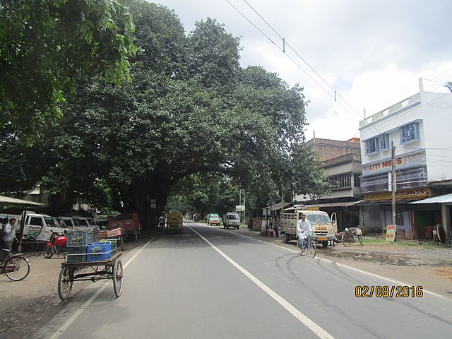
State Highway 2 (SH 2) is a state highway in West Bengal, India.
Remove ads
Remove ads
Route

SH 2 originates from its junction with NH 14 at Bankura and passes through Indpur, Hatimrampur, Khatra, Simlapal, Taldangra, Bishnupur, Jaypur, Kotulpur, Arambag, Champadanga, Tarakeswar, Singur, Baidyabati, Dankuni, Uttarpara, Baranagar, Dakshineswar, Barrackpore, Barasat, Berachampa, Kholapota, Basirhat, Taki and terminates at its junction with SH 3 at Malancha in North 24 Parganas district.[1]

National Highway Authority of India or NHAI has proposed to include section of SH 2 from Simlapal via Taldangra, Bishnupur, Jaypur, Kotulpur, Arambag to Champadanga under a new National Highway for 2022/23, but details not decided yet. The new highway will connect Jhargram with Dankuni via Jhilimili, Mukutmanipur, Simlapal, Taldangra, Bishnupur, Jaypur, Kotulpur, Arambag, Champadanga & Chanditala. The new proposed National Highway will merge SH 2, SH 5 & SH 15 into a single route covering distance of 296 kilometres (184 mi).
The total length of SH 2 is 323 km.[2]
Districts traversed by SH 2 are:[3]
Bankura district (0 - 117 km)
Hooghly district (117 - 196 km)
North 24 Parganas (196 - 323 km)
Remove ads
Road sections
It is divided into different sections as follows:[2][4][5][6]
Remove ads
See also
External links
 Media related to State Highway 2 (West Bengal) at Wikimedia Commons
References
Wikiwand - on
Seamless Wikipedia browsing. On steroids.
Remove ads
