Top Qs
Timeline
Chat
Perspective
National Highway 9 (India)
National highway in India From Wikipedia, the free encyclopedia
Remove ads
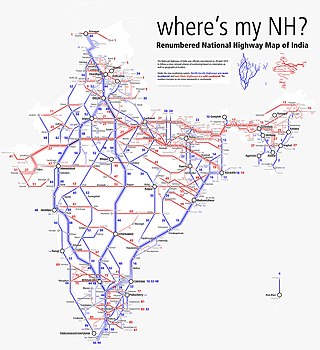
National Highway 9 (NH 9) is a National Highway in India in east-west direction. It starts at Fazilka in Punjab and ends at Gori Ganga Bridge at Askot in Pithoragarh (Kumaun) District of Uttarakhand[1] in Pithoragarh district in Uttarakhand. It passes through the states of Punjab, Haryana, Delhi, Uttar Pradesh and Uttarakhand.[2] After renumbering of all national highways by National Highway Authority of India in 2010, the current NH 9 was formed by merging segments of five separate national highways in 2010; these were Old NH 10 (Fazilka-Delhi section), Old NH 24 (Delhi-Rampur section), Old NH 87 (Rampur-Rudrapur section), Old NH 74 (Rudrapur-Sitarganj-Khatima section) and Old NH 125 (Tanakpur-Pithoragarh section).
This article needs additional citations for verification. (January 2017) |
Remove ads
Remove ads
Route
Starting at Fazilka in Punjab and ending at Gori Ganga Bridge Askot in the State of Uttarakhand, it passes connects several important cities in five states in North India (from west towards east):[3][4] The highway runs 954 kilometres (593 mi) end to end and is also known as Kailash Mansarovar Road in Uttarakhand.
Remove ads
Map with spur routes
See also
Gallery
- NH 9 at Malout (Punjab)
- NH 9 near Khatima(near SITARGANJ) (Uttarakhand)
References
External links
Wikiwand - on
Seamless Wikipedia browsing. On steroids.
Remove ads


