National Highway 43 (India)
National highway in India From Wikipedia, the free encyclopedia
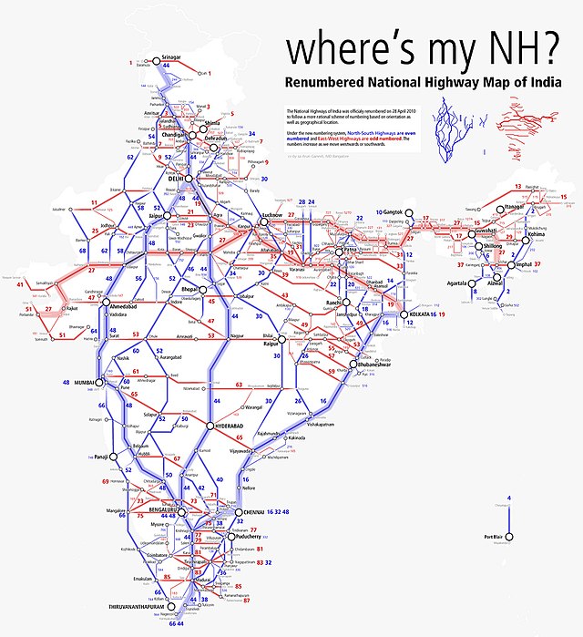
National Highway 43 (NH 43) is a primary National Highway in India.[1] It traverses from Gulluganj in Madhya Pradesh, through Chhattisgarh and terminates at Chaibasa in Jharkhand. This national highway is 1,062.5 km (660.2 mi) long.[2][3] Before renumbering of national highways NH-6 was variously numbered as old national highways 78, 23 & 33.[4]
| National Highway 43 | ||||
|---|---|---|---|---|
| Route information | ||||
| Length | 1,062.5 km (660.2 mi) | |||
| Major junctions | ||||
| West end | Gulluganj, Madhya Pradesh | |||
| East end | Chaibasa, Jharkhand | |||
| Location | ||||
| Country | India | |||
| States | Madhya Pradesh, Chhattisgarh, Jharkhand | |||
| Highway system | ||||
| ||||
Route

Madhya Pradesh
Gulluganj, Rajpua Amanganj, Pawai, Katni, Umaria, Shahdol, Anuppur, Kotma.[3]
Chhattisgarh
Manendragarh, Baikunthpur, Surajpur, Ambikapur, Pathalgaon, Jashpurnagar.[2]
Jharkhand
Gumla,Sisai, Bero, Nagri, Ranchi, Bundu, Tamar, Chandil, Seraikela, Chaibasa.[2]
As per recent developement, the Shahdol-Rewa Road is renumbered as National Highway 243 (India)|NH243' which runs for 170 kilometres (110 mi) via Jaisinghnagar, Beohari, Bansagar & Govindgarh.
Junctions
This article contains a bulleted list or table of intersections which should be presented in a properly formatted junction table. (November 2021) |
NH243(Shahdol-Rewa Road) near Shahdol.
Route conditions
NH43 is sadly one of the worst Highways of India. The highway is 4 laned in Tamar - Ranchi - Patra near Gumla stretch only covering just 142 kilometres (88 mi) of the total route. Rest 819 kilometres (509 mi) stretch is 2 laned with 4 lane is now being constructed in 300 kilometres (190 mi) more distance. The stretch between Ambikapur to Jashpurnagar is very seriously in bad conditions. The stretch between Gulluganj to Katni is also in serious bad conditions.
See also
References
External links
Wikiwand - on
Seamless Wikipedia browsing. On steroids.

