List of mountains in the Philippines
From Wikipedia, the free encyclopedia
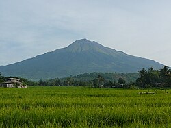
The following is an incomplete list of mountains in the Philippines. Several of these are volcanoes, formed by subducting tectonic plates surrounding the archipelago.[1]
List
Summarize
Perspective

Terrain of the Philippines
This list contains most of the highest mountains in the country. It is limited to mountain peaks with, if known, an elevation of at least 200 metres (660 feet) above sea level, and may include those considered as hills. The distinction between a hill and a mountain in terms of elevation is unclear and largely subjective, but a hill is universally considered to be less tall and less steep than a mountain.[2]
- Name: mountains are sorted according to only names (without the "Mount" prefix) for easier reference in name and spelling variants. Unnamed peaks are italicized. (note: to minimize clutter, citations for names are limited only to mountains with variant names, spellings, and/or those that currently do not have elevation data)
- Elevation: sorted in meters above sea level (note: Some mountains may contain several different elevations that may conflict with each other. Each of these are supported by their own provided sources).
- Province(s) covered: Some mountains are situated within two or more provinces borders. "Lanao" and "Davao" entries, which were derived from the Philippine Institute of Volcanology and Seismology website, are italicized since they are no longer provinces.
- Coordinates: sorted according to latitude. Several of these (most especially volcanoes) were provided by the PHIVOLCS website). Others were derived mostly from the OpenStreetMap (OSM) database (released under the Open Database License), and a few from GeoNames (released under the Creative Commons attribution license).
- Notes: if a volcano, may contain the type, as classified by the PHIVOLC
| ultra prominent peak (with topographic prominence greater than 1,500 metres (4,900 feet))[3] | |
| ultra prominent peak[3] and highest in the island | |
| ‡ | active volcano (erupted within historical times (within the last 600 years)[1] |
| † | potentially-active volcano (morphologically young-looking but with no historical records of eruption)[1] |
| no data or inactive/extinct volcano (no record of eruptions; physical form is being changed by agents of weathering and erosion)[1] (check "Notes" section) | |
Gallery
- Dulang-dulang, Philippines' 2nd highest
- Mayon, highest in the Bicol Region
See also
Wikimedia Commons has media related to Mountains of the Philippines.
Notes
References
Wikiwand - on
Seamless Wikipedia browsing. On steroids.


