Biliran (volcano)
Volcano in the Philippines From Wikipedia, the free encyclopedia
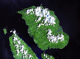
Mount Biliran is a solfataric active complex volcano located in the island province of Biliran in the Philippines. The volcano caused the formation of the island.

| Biliran | |
|---|---|
| Highest point | |
| Elevation | 1,340 m (4,400 ft)[1] |
| Prominence | 199 m (653 ft) |
| Coordinates | 11°39′00″N 124°32′06″E[1] |
| Geography | |
| Location | Biliran province, Eastern Visayas region, Visayas island group, Philippines |
| Geology | |
| Rock age | Quaternary[1] |
| Mountain type | Complex volcano |
| Last eruption | September 26, 1939[1] |
Geological features
- Rock Type: Hornblende andesite containing greenish and black hornblende
- Tectonic Setting: Biliran Volcano is part of the curvilinear belt of Quaternary volcanoes in eastern Philippines, parallel to Phil. Trench to the east
Volcanic activity
- Number of Historical Eruptions: 1
- Latest Eruption/Activity: September 26, 1939
- Site: crater
- Eruption Character: Debris avalanche
- Affected Areas/Remarks: Ashfall at Caibiran and adjoining areas (6.35 cm thick deposits)
- Monitoring activity: Short-term monitoring in 1954
Physical features
- Hotsprings:
- Central Biliran – Libtong Thermal Areas (12 hot springs and one bubbling pool)
- North Biliran – Panamao Thermal Area
- Anas Thermal Area
- South Biliran – Kalambis Thermal Area
- Adjacent Volcanic Edifice:
- Panamao (107 m asl)
- Gumansan (1064 m asl)
- Lauan (1187 m asl)
- Suiro (1301 m asl)
See also
References
External links
Wikiwand - on
Seamless Wikipedia browsing. On steroids.

