Gangadharpur
Census town in West Bengal, India From Wikipedia, the free encyclopedia
Gangadharpur is a census town in the Chanditala I CD block located in the Srirampore subdivision of the Hooghly district in the state of West Bengal, India.[1]
Gangadharpur | |
|---|---|
Census town | |
 Gangadharpur street view | |
 Gangadharpur Location in West Bengal, India  Gangadharpur Gangadharpur (India) | |
| Coordinates: 22.76°N 88.22°E | |
| Country | India |
| State | West Bengal |
| District | Hooghly |
| Nearest city | Serampore |
| Government | |
| • Type | Gram panchayat |
| • Body | Gangadharpur gram panchayat |
| Area | |
• Total | 2.19 km2 (0.85 sq mi) |
| Elevation | 14 m (46 ft) |
| Population (2011) | |
• Total | 7,862 |
| • Density | 3,600/km2 (9,300/sq mi) |
| Languages | |
| • Official | Bengali, English |
| Time zone | UTC+5:30 (IST) |
| PIN | 712306 |
| Telephone code | 03212 |
| ISO 3166 code | IN-WB |
| Vehicle registration | WB |
| Sex ratio | 979 females/1000 males ♂/♀ |
| Literacy rate | 83.52 % |
| Lok Sabha constituency | Serampore |
| Vidhan Sabha constituency | Chanditala |
| Website | Gangadharpur |
Geography
Summarize
Perspective


4km
2.5miles
2.5miles
R
Kotalpur
CT
Krishnapur
CT
Garalgachha
CT
Barijhati
CT
Pairagchha
CT
Janai
CT
Chikrand
CT
Naiti
CT
Panchghara
CT
Baksa
CT
Begampur
CT
Purba Tajpur
CT
Jaykrishnapur
CT
Kapashanria
CT
Tisa
CT
Kharsarai
R
Chanditala
CT
Bhagabatipur
CT
Ramanathpur
CT
Kumirmora
CT
Nababpur
CT
Dudhkalmi
CT
Manirampur
CT
Gangadharpur
CT
Jangalpara
CT
Masat
R
Furfura Sharif
R
Antpur
R
Jangipara
CT
Rajbalhat
M
Dankuni
Cities and towns in Chanditala I, Chanditala II and Jangipara CD blocks in Srirampore subdivision in Hooghly district
M: municipal city/ town, CT: census town, R: rural/ urban centre.
Owing to space constraints in the small map, the actual locations in a larger map may vary slightly.
M: municipal city/ town, CT: census town, R: rural/ urban centre.
Owing to space constraints in the small map, the actual locations in a larger map may vary slightly.
Location
Gangadharpur is located at 22°46′N 88°13′E.[2] It has an elevation of 14 metres (46 feet) and is located in the Chanditala–I community development block under the Srirampore subdivision of the Hooghly district. The Chanditala police station serves this town. There is a small river in the locale that is called Kana Nadi "(Bengali:কানা নদী)", which means "blind river."
It is 26 km from the district headquarters of Hooghly and 30 km from the state capital Kolkata.[3]
According to the District Census Handbook of 2011, Gangadharpur covered an area of 2.193 km2.[4]
Gangadharpur, Manirampur, Masat, Jangalpara, Dudhkalmi, Nababpur, Bhagabatipur, Kumirmora and Ramanathpur form a cluster of census towns in the Chanditala I CD block.[5]
Urbanisation
The Srirampore subdivision is the most urbanized of the subdivisions in Hooghly district. 73.13% of the population lives in urban area and 26.88% lives in rural areas. The subdivision has six municipalities and 34 census towns. The municipalities are Uttarpara Kotrung Municipality, Konnagar Municipality, Serampore Municipality, Baidyabati Municipality, Rishra Municipality and Dankuni Municipality. Amongst the CD blocks in the subdivision, Uttarapara Serampore had a population that was 76% urban, Chanditala I am population that was 42% urban, Chanditala II a population that was 69% urban and Jangipara a population that was 7% urban.[6][7]
Gram panchayat
The Gangadharpur gram panchayat is the local self-government of the village.[citation needed] The panchayat is divided into wards, each represented by an elected ward member. The ward members are headed by a sarpanch.

The villages and census towns in Gangadharpur gram panchayat are Bankrishnapur, Gangadharpur, Malipukur and Manirampur.[8]
Area
Gangadharpur has an area of 2.19 km2.
Market
The Ganngadharpur Bazaar[9] caters to the town.

Demographics
As of 2011[update],[10] Gangadharpur had a population of 7,862. Males constituted 51% of the population and females 49%. Gangadharpur had an average literacy rate of 83.5%, higher than the state average of 76.26%; with 87.72% of the literates being male and 79.27% being female. Nine percent of the population was under 6 years of age.
Dankuni Urban Agglomeration
As per the 2011 census, the Dankuni Urban Agglomeration includes Dankuni (M), Purba Tajpur (CT), Kharsarai (CT), Begampur (CT), Chikrand (CT), Pairagachha (CT), Barijhati (CT), Garalgachha (CT), Krishnapur (CT), Baruipara (CT), Borai (CT), Nawapara (CT), Basai (CT), Gangadharpur (CT), Manirampur (CT), Janai (CT), Kapashanria (CT), Jaykrishnapur (CT), Tisa (CT), Baksa (CT), Panchghara (CT) and Naiti (CT).[11]
Politics
Kalyan Banerjee of All India Trinamool Congress is the representative in Parliament, and Swati Khandekar of All India Trinamool Congress is the Member of Legislative Assembly.
Festivals
Like other parts of West Bengal, Durga Puja is the biggest festival of Gangadharpur. Kali Puja is one of the famous festivals celebrated in Gangadharpur. Additionally, Lakshmi Puja, Viswakarma Puja, Saraswati Puja, Poila Boisakh-Ganesh Puja, Kartik Puja and Dol Yatra are widely celebrated at Gangadharpur.
Temples
- Siv temple (Nimtala Gangadharpur south)
- Durga Temple (Mannapara, Gangadharpur south)
- Tarama Temple (Santrapara, Gangadharpur south )
- Kali Temple (Gangadharpur Bazaar)
- Radha Gobindo Temple (Radha Gobindo Tala, Gangadharpur Bazaar)
- Sitola Temple (Manna para Gangadharpur south)
- Shubochandi Temple (Shubochanditala Gangadharpur)
Ashrams
- Saradaghata Ashram (Pakirapara Gangadharpur south)
- Kultala Ashram (Daspara Gangadharpur south)

Transport
Transportation is mainly based on public transport like bus services and small vehicles like autos.
Air
The nearest airport is the Netaji Subhas Chandra Bose International Airport in Dum Dum, Kolkata.
Rail
The nearest railway station, Baruipara railway station, on the Howrah-Bardhaman chord line, is 26 km from Howrah Station and is a part of the Kolkata Suburban Railway system.[12][13]
Road
The main road is 31 Number Road. It is the main artery of the town and it is connected with Ahilyabai Holkar Road (Sehakhala), National Highway 19 (Bora), State Highway 13 (Milki Badamtala) and State Highway 6/ G.T. Road (Nabagram).[13]
There is 31 Number Private Bus from Jangipara bus stand to Serampore bus stand via Furfura Sharif, Sehakhala, Banmalipur, Gangadharpur, Baruipara, Bora and Milki Badamtala. Another road renovated under Gangadharpur-Singur Road is connected to State Highway 2. There is auto and trecker service from Singur and Baruipara to Masat via Gangadharpur. Gangadharpur-Jangalpara Road is also connected with State Highway 15.
Economy
Textiles
Gangadharpur's textile industry is the main cotton weaving center in West Bengal. They are involved in the weaving of fine-textured saris and dhotis. The saris of Gangadharpur have deep and bright colours.[14]
Other livelihoods
Most of the people are goldsmiths, and the rest are dependent on farming, with a few service men.
Healthcare
This section needs expansion. You can help by adding to it. (June 2020) |
Gangdharpur has a Primary Health Centre with 10 beds.[15][16]
Gallery
 Kultala Ashram Gangadharpur
 Gangadharpur gram panchayat
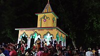 Gangadharpur Saradaghata Asharam
 Baruipara railway station is 1.5 km from Gangadharpur.
 Gangadharpur Bazaar, 31 Number Road, Hooghly
 Gangadharpur Primary Health Centre
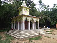 Gangadharpur Saradaghata Ashram
 Gangadharpur street view
 Gangadharpur gram panchayat


References
Wikiwand - on
Seamless Wikipedia browsing. On steroids.