File:Neusiedler_Lake_satellite.png
From Wikipedia, the free encyclopedia
Size of this preview: 510 × 600 pixels. Other resolutions: 204 × 240 pixels | 408 × 480 pixels | 797 × 937 pixels.
Original file (797 × 937 pixels, file size: 1.39 MB, MIME type: image/png)
| This is a file from the Wikimedia Commons. Information from its description page there is shown below. Commons is a freely licensed media file repository. You can help. |
Summary
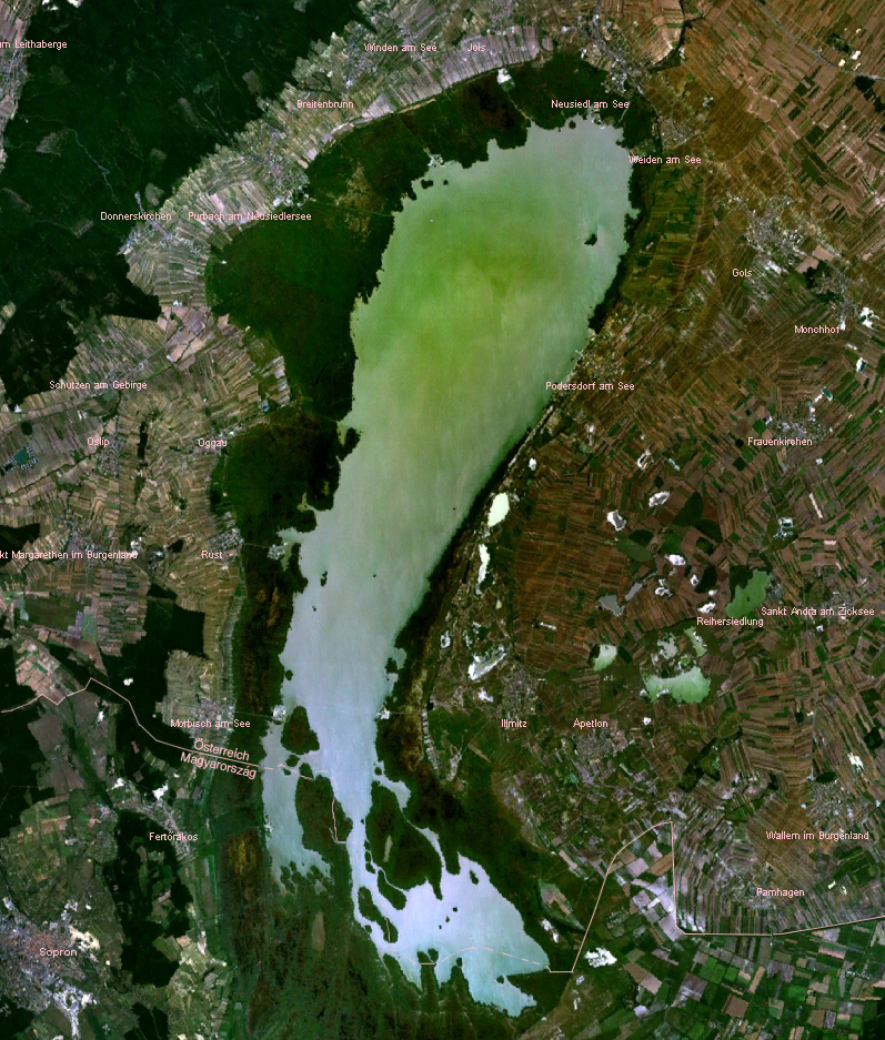
Satellite view of Neusiedler Lake in Austria / Fertő-tó in Hungary. Taken from de:Bild:Neusiedlersee NASA WorldWind.png.
Licensing
| Public domainPublic domainfalsefalse |
| This image is in the public domain because it is a screenshot from NASA’s globe software World Wind using a public domain layer, such as Blue Marble, MODIS, Landsat, SRTM, USGS or GLOBE.
العربيَّة | English | فارسی | français | עברית | македонски | മലയാളം | Nederlands | русский | 中文(中国大陆) | +/− |
 |
File history
Click on a date/time to view the file as it appeared at that time.
| Date/Time | Thumbnail | Dimensions | User | Comment | |
|---|---|---|---|---|---|
| current | 15:01, 6 May 2020 | | 797 × 937 (1.39 MB) | Julieta39 | Change since discussion file |
| 12:08, 27 December 2018 |  | 797 × 937 (1.39 MB) | Julieta39 | Austrian-Hungarian border | |
| 21:28, 7 February 2007 |  | 797 × 937 (1.39 MB) | Editor at Large | Re-uploading, problem with last version | |
| 21:22, 7 February 2007 |  | 797 × 937 (1.58 MB) | Editor at Large | Removed logo in corner |
File usage
The following pages on the English Wikipedia use this file (pages on other projects are not listed):
Global file usage
The following other wikis use this file:
- Usage on af.wikipedia.org
- Usage on ar.wikipedia.org
- Usage on az.wikipedia.org
- Usage on bar.wikipedia.org
- Usage on br.wikipedia.org
- Usage on cs.wikipedia.org
- Usage on cv.wikipedia.org
- Usage on da.wikipedia.org
- Usage on de.wikipedia.org
- Usage on de.wiktionary.org
- Usage on el.wikipedia.org
- Usage on es.wikipedia.org
- Usage on fa.wikipedia.org
- Usage on fi.wikipedia.org
- Usage on fr.wikipedia.org
- Usage on he.wikipedia.org
- Usage on hr.wikipedia.org
- Usage on hu.wikipedia.org
- Usage on hy.wikipedia.org
- Usage on id.wikipedia.org
- Usage on it.wikipedia.org
- Usage on ja.wikipedia.org
- Usage on ka.wikipedia.org
- Usage on li.wikipedia.org
- Usage on mk.wikipedia.org
- Usage on mt.wikipedia.org
- Usage on nl.wikipedia.org
- Usage on no.wikipedia.org
- Usage on pl.wikipedia.org
- Usage on pl.wiktionary.org
- Usage on pnb.wikipedia.org
- Usage on ro.wikipedia.org
View more global usage of this file.
Metadata
This file contains additional information, probably added from the digital camera or scanner used to create or digitize it.
If the file has been modified from its original state, some details may not fully reflect the modified file.
| Horizontal resolution | 28.35 dpc |
|---|---|
| Vertical resolution | 28.35 dpc |
Retrieved from "https://en.wikipedia.org/wiki/File:Neusiedler_Lake_satellite.png"