Sagamu
From Wikipedia, the free encyclopedia
From Wikipedia, the free encyclopedia
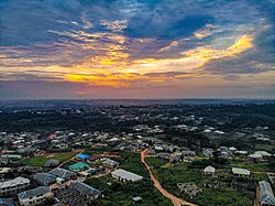
Sagamu tàbí Ishagamu jẹ́ ìlú àti olú-ìlú ìjọba ìbílẹ̀ kan tí ó wà ní apá Gúúsù Ìwọ̀-oòrùn Ìpìnlẹ̀ Ògùn lẹ́gbẹ̀ẹ́ Odò Ibu.[2] Sagamu sì jẹ́ àkójọpọ̀ ìlú mẹ́tàlá ní ìpínlẹ̀ Ògùn lọ́nà odò Ibu àti odò Ewuru, láàrin ipinle Eko àti Ibadan. Wọ́n sì dasílẹ̀ láàrin sẹ́ńtúrì kọkàndínlógún nípa sẹ̀ ọmọ-ẹgbẹ́ Yorùbá,[3]ní apá Guusu Ìwọ̀-oòrun orílẹ̀-èdè Nàìjíríà. Àwọn ìlú mẹ́tàlá tí ó wà nínú rẹ̀ ni: Makun, Ofin Sonyindo, Epe, Ibido, Igbepa, Ado, Oko, Ipoji, Batoro, Ijoku, Latawa ati Ijagba.[4][5] Ó sì jẹ́ olú-ìlú Rẹ́mo, ẹni tí ó jẹ́ apàṣẹ ìlú Remo ni a mọ̀ sí Oba Akarigbo. Ìlú Ofin sì ni ààfin Ọba Akarigbo wà.
Sagamu Orisagamu | |||
|---|---|---|---|
LGA | |||
 Agbègbè Araromi | |||
| Coordinates: 6°50′N 3°39′E | |||
| Country | |||
| State | Ogun State | ||
| LGA(s) | Sagamu | ||
| Government | |||
| • Local Government Chairman | Odulate Olashile (APC) | ||
| Area | |||
| • Total | 614 km2 (237 sq mi) | ||
| Population (2006 census) | |||
| • Total | 253,412 | ||
| Time zone | UTC+1 (WAT) | ||
| 3-digit postal code prefix | 121[1] | ||
| ISO 3166 code | NG.OG.SH | ||
| National language | Yorùbá | ||
| |||
Seamless Wikipedia browsing. On steroids.
Every time you click a link to Wikipedia, Wiktionary or Wikiquote in your browser's search results, it will show the modern Wikiwand interface.
Wikiwand extension is a five stars, simple, with minimum permission required to keep your browsing private, safe and transparent.