Caraga is an administrative region in the Philippines. It is also known as Region XIII. It is on the northeastern part of the island of Mindanao. Butuan is the regional administrative center.

Quick Facts Country, Island group ...
Caraga
Caraga Administrative Region
Region XIII
Thumb
Thumb
Thumb
Thumb
Thumb
Thumb
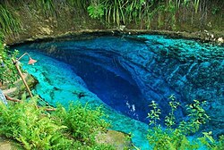
From top, left to right: A naked beach in Siargao Island; Tinuy-an Falls; Rice Corn and Flower Festival in Bayugan; Macapagal Bridge in Butuan; A lagoon in Libjo; Hinatuan Enchanted River
Thumb
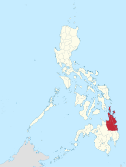
Location in the Philippines
Coordinates: 8°55′N 125°30′E
CountryPhilippines
Island groupMindanao
Regional centerButuan
Area
  Total21,478.35 km2 (8,292.84 sq mi)
Population
 (2020 census)[1]
  Total2,804,788
  Density130/km2 (340/sq mi)
Time zoneUTC+8 (PST)
ISO 3166 codePH-13
Provinces
Cities
6
Municipalities70
Barangays1,310
Cong. districts7
Languages
Close

There are five provinces: Agusan del Norte, Agusan del Sur, Dinagat Islands, Surigao del Norte, and Surigao del Sur.

References

Wikiwand in your browser!

Seamless Wikipedia browsing. On steroids.

Every time you click a link to Wikipedia, Wiktionary or Wikiquote in your browser's search results, it will show the modern Wikiwand interface.

Wikiwand extension is a five stars, simple, with minimum permission required to keep your browsing private, safe and transparent.