Melsungen
From Wikipedia, the free encyclopedia
From Wikipedia, the free encyclopedia
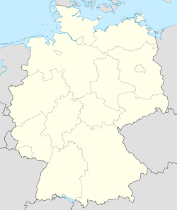
Melsungen on kaupunki Schwalm-Eder-Kreisin piirikunnassa Hessenin osavaltiossa keskisessä Saksassa. Se sijaitsee noin 130 kilometriä Frankfurt am Mainista koilliseen ja noin 20 kilometriä Kasselista etelään.[2][3]
| Melsungen | |
|---|---|
.JPG) |
|
 vaakuna |
|
 Melsungen |
|
|
Koordinaatit: |
|
| Valtio | Saksa |
| Osavaltio | Hessen |
| Piirikunta | Schwalm-Eder-Kreis |
| Pinta-ala | |
| – Kokonaispinta-ala | 63,1 km² |
| Korkeus | 172 m |
| Väkiluku (2018) | 13 662[1] |
| – Väestötiheys | 217 as./km² |
| Postinumero | 34212 |
| Suuntanumero(t) | 05661, 05602 |

Melsungen sijaitsee Hessenin koillisosan ylänköseudulla. Kaupungin itäpuolella on Melsungen Bergland -niminen mäkimaa ja länsipuolella vastaavasti Homberger Hochland -niminen ylänkö. Edellä mainitut ylängöt kuuluvat matalahkoon Knüllgebirge-vuoristoon, jonka korkein kohta, Eisenberg, sijaitsee 635,5 merenpinnan yläpuolella. Melsungenin korkein kohta, Himmelsberg, kohoaa 557 metriä merenpinnan yläpuolelle. Kaupungin keskustan halki virtaa 220-kilometrinen Fulda, joka on Weserin sivujoki.
Varhaisin asiakirjamaininta Melsungenista on vuodelta 800. Alueella on todennäköisesti asuttu jo Hallstattin kulttuurin aikana satoja vuosia ennen ajanlaskun alkua. Kaupunkimaiseksi asutuskeskukseksi Melsungen oli kasvanut 1100-luvun loppuun mennessä. Paikkakunta oli usein maallisten ja kirkollisten vallanhavittelijoiden kiistakapulana. Melsungenin linna eli Schloss Melsungen rakennettiin 1550-luvulla. Se edustaa arkkitehtuuriltaan niin sanottua Weserin renessanssia. Tuonnempana Melsungen kärsi kolmikymmenvuotisesta sodasta ja seitsenvuotisesta sodasta.[4]
Melsungen kohtasivat useat keskiaikaiset kauppareitit. Kaupunki ei ollut ainoastaan ohikulkupaikka, vaan myös kauppapaikka, jossa järjestettiin säännöllisesti markkinoita. Vuosina 1821–1973 Melsungen oli Landkreis Melsungenin hallintokeskus. Melsungenin piirikunnasta ja sen naapureista eli Fritzlar-Hombergin ja Ziegenhainin piirikunnista muodostettiin Schwalm-Eder-Kreisin piirikunta Hessen aluehallintouudistuksen yhteydessä 1970-luvulla.[4]
Melsungenin teollisuusyrityksiin lukeutuu lääketieteellisiin tuotteisiin erikoistunut B. Braun Melsungen. Sen juuret ulottuvat 1830-luvulle.[5] Elintarviketeollisuuden perinteet ovat myös pitkät, ja demografisesti keskeinen sijainti on oivallinen alan logistiikan kannalta.
Melsungenin rautatieasema sijaitsee rataosuudella Bebra–Baunatal-Guntershausen. Kaupungin halki kulkee Bundesstraße 83 ja BAB 7 -moottoritie kulkee keskustan länsipuolitse. Yli tuhatkilometrinen D-Route 9 (Weser-Romantische Straße) -polkupyöräreitti kulkee Melsungenin kautta. 260-kilometrinen pyörätie Fulda-Radweg (Hessische Radfernweg R1) on reititetty niin ikään Melsungenin kautta.
Seamless Wikipedia browsing. On steroids.
Every time you click a link to Wikipedia, Wiktionary or Wikiquote in your browser's search results, it will show the modern Wikiwand interface.
Wikiwand extension is a five stars, simple, with minimum permission required to keep your browsing private, safe and transparent.
