Wudu, Longnan
District in Gansu, China From Wikipedia, the free encyclopedia
Wudu District (Chinese: 武都区) is a district and the political and cultural centre of Longnan, Gansu province, China.[2] It borders the provinces of Shaanxi and Sichuan to the southeast. It has a population of 590,000, of which 110,000 live in the urban area.[3]
Wudu
武都区 | |
|---|---|
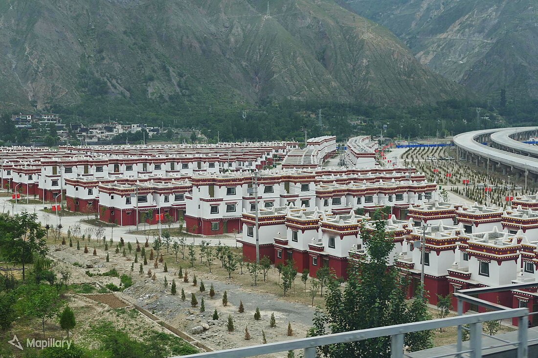
 Tibetan-style homes in Pingya, Wudu | |
 Wudu in Longnan | |
 Longnan in Gansu | |
| Coordinates: 33°22′13″N 104°57′37″E | |
| Country | China |
| Province | Gansu |
| Prefecture-level city | Longnan |
| District seat | Zhonglou Subdistrict |
| Area | |
| • Total | 4,683 km2 (1,808 sq mi) |
| Population (2020 census)[1] | |
| • Total | 546,616 |
| • Density | 120/km2 (300/sq mi) |
| Time zone | UTC+8 (China Standard) |
| Postal code | 746000 |
| Website | www |
| Wudu, Longnan | |||||||||||
|---|---|---|---|---|---|---|---|---|---|---|---|
| Chinese name | |||||||||||
| Simplified Chinese | 武都区 | ||||||||||
| Traditional Chinese | 武都區 | ||||||||||
| |||||||||||
| Tibetan name | |||||||||||
| Tibetan | བོད་ཏོག་ཆུས། | ||||||||||
| |||||||||||
Located along the Bailong River near the borders with Sichuan and Shaanxi, it has been the site of many historic battles. A town has existed at the current county seat since at least 448. In 572 this town was named Wuzhou (武州), in 892 it was named Jiezhou. Since 1260 it was part of Shaanxi province, becoming part of Gansu in 1729. In 1913, Wudu County was established. The current district was established from Wudu County in 2004.[4]
The epicentre of the 1879 Gansu earthquake was located in the district.
Wudu is one of the top tourist destinations in Gansu, receiving over 2 million tourists in 2016.[5] The Wanxiang karst cave is located 10 km from the city.[6] Its agricultural output includes olive cultivation, traditional Chinese medicine crops and Sichuan pepper.[7][8][9][10]
Administrative divisions
Wudu District is divided to 4 subdistricts, 26 towns, 8 townships and 2 ethnic townships.[11][12]
- Subdistricts
|
|
- Towns
|
|
|
- Townships
|
|
- Ethnic townships
- Pingya Tibetan Ethnic Township (坪垭藏族乡)(Tibetan: ཕིང་ཡག་བོད་རིགས་ཤང་།(Wylie: phing yag bod-rigs shang, ZYPY: Pingyag Poirig Xang))
- Moba Tibetan Ethnic Township (磨坝藏族乡)
Transport
See also
References
Wikiwand in your browser!
Seamless Wikipedia browsing. On steroids.
Every time you click a link to Wikipedia, Wiktionary or Wikiquote in your browser's search results, it will show the modern Wikiwand interface.
Wikiwand extension is a five stars, simple, with minimum permission required to keep your browsing private, safe and transparent.

