Tingri County
County in Tibet, China From Wikipedia, the free encyclopedia

Tingri County (Tibetan: དིང་རི་རྫོང་།; simplified Chinese: 定日县; traditional Chinese: 定日縣; pinyin: Dìngrì Xiàn) is a county under the administration of the prefecture-level city of Xigazê in the Tibet Autonomous Region of China.[2]
Tingri County
定日县 • དིང་རི་རྫོང་། Dhringgri | |
|---|---|
 A man riding a dzo in Tingri County, 1993 | |
.png) Location of Tingri County (red) within Xigazê City (yellow) and the Tibet Autonomous Region | |
 Tingri County Location of the seat in the Tibet Autonomous Region  Tingri County Tingri County (China) | |
| Coordinates (Tingri County seat, Shelkar): 28°39′36″N 87°7′30″E | |
| Country | China |
| Autonomous region | Tibet |
| Prefecture-level city | Xigazê |
| County seat | Shelkar |
| Area | |
• Total | 13,861.21 km2 (5,351.84 sq mi) |
| Population (2020)[1] | |
• Total | 58,173 |
| • Density | 4.2/km2 (11/sq mi) |
| Time zone | UTC+8 (China Standard) |
| Website | www |
| Tingri County | |||||||
|---|---|---|---|---|---|---|---|
| Chinese name | |||||||
| Simplified Chinese | 定日县 | ||||||
| Traditional Chinese | 定日縣 | ||||||
| |||||||
| Tibetan name | |||||||
| Tibetan | དིང་རི་རྫོང་། | ||||||
| |||||||
The county comprises the upper valley of the Bum-chu or Arun River, with the valleys of its tributaries, the valleys of the Rongshar Tsangpo and the Lapchi Gang Tsanpo which flow south into Nepal. It is bordered on the south by the main range of the Himalayas, including Mount Everest (Tib. Jomolangma), Makalu and Cho Oyu. The present county administration is located at Shelkar, about 87 km (54 mi) east of Tingri (town).[3]
Tingri is one of the four counties (the other three being Dinjie, Nyalam, and Kyirong) that comprise the Qomolangma National Nature Preserve,[4] a protected area spanning 3.381 million hectares.
Toponymy
Tingri County is named after a nearby hill, which itself is reportedly named after the sound a falling stone made when it hit the hill.[5]
History
Shelkar Dzong was built in the area of the present-day county during the time of the Kashag.[5]
In 1960, Dingri County was established, and in June of that year, a local county government was established.[5] The county headquarters were originally established in Shelkar, but were moved to Gangga in August.[5] In July 1968, the local government moved back to Shelkar, where it remains today.[5]
In 1992, the county was added to the Qomolangma National Nature Preserve.[6]
On 7 January 2025 at 09:05 CST (UTC+8), an earthquake measuring Mw 7.1 or Ms 6.8 struck Tingri County. Several villages experienced near-total destruction and at least 126 people died and hundreds more were injured.[7]
Geography
Summarize
Perspective
Dingri County is a county under the jurisdiction of prefecture-level city of Xigazê. It is located in the southern part of the Tibet Autonomous Region and the south-central part of Xigazê.[6] It borders Dinggyê County and Sa'gya County to the east, Nyalam County to the west, Ngamring County to the north, Lhatse County to the northeast, and Nepal to the south.[6] It is 115 kilometres (71 mi) long from east to west and 152 kilometres (94 mi) wide from north to south, with a total area of about 14,000 square kilometres (5,400 sq mi).[6]
Tingri County is located at the northern foot of the middle section of the Himalayas, and at the northern foot of Mount Everest.[6] The county's landscape is extremely mountainous, with an average altitude of more than 5,000 metres (16,000 ft) above sea level, and the county seat situated at an altitude of 4,300 metres (14,100 ft) above sea level.[6] The world's highest peak, Mount Everest, and the world's sixth-highest mountain, Cho Oyu, are located in the county.[6]
The Arun River flows eastward out of the country.[6]
Climate
Tingri County's climate has large temperature differences between day and night, a high amount of sunshine hours, and little annual precipitation. On January 7, 1966, Tingri County recorded the lowest temperature ever recorded in Tibet at −46.4 °C (−51.5 °F). [6]
| Climate data for Tingri, elevation 4,300 m (14,100 ft), (1991–2020 normals, extremes 1981–2018) | |||||||||||||
|---|---|---|---|---|---|---|---|---|---|---|---|---|---|
| Month | Jan | Feb | Mar | Apr | May | Jun | Jul | Aug | Sep | Oct | Nov | Dec | Year |
| Record high °C (°F) | 14.7 (58.5) |
15.0 (59.0) |
18.7 (65.7) |
20.8 (69.4) |
23.8 (74.8) |
25.1 (77.2) |
25.8 (78.4) |
23.4 (74.1) |
22.8 (73.0) |
19.3 (66.7) |
17.2 (63.0) |
13.4 (56.1) |
25.8 (78.4) |
| Mean daily maximum °C (°F) | 3.7 (38.7) |
5.1 (41.2) |
8.3 (46.9) |
11.9 (53.4) |
16.1 (61.0) |
20.2 (68.4) |
19.5 (67.1) |
18.2 (64.8) |
17.5 (63.5) |
13.3 (55.9) |
8.8 (47.8) |
5.8 (42.4) |
12.4 (54.3) |
| Daily mean °C (°F) | −6.4 (20.5) |
−4.4 (24.1) |
−0.8 (30.6) |
3.1 (37.6) |
7.6 (45.7) |
12.1 (53.8) |
12.6 (54.7) |
11.6 (52.9) |
10.1 (50.2) |
4.0 (39.2) |
−1.6 (29.1) |
−5.2 (22.6) |
3.6 (38.4) |
| Mean daily minimum °C (°F) | −16.1 (3.0) |
−14.1 (6.6) |
−10.1 (13.8) |
−5.4 (22.3) |
−0.2 (31.6) |
5.2 (41.4) |
7.4 (45.3) |
6.9 (44.4) |
4.1 (39.4) |
−4.2 (24.4) |
−10.9 (12.4) |
−14.9 (5.2) |
−4.4 (24.1) |
| Record low °C (°F) | −46.4 (−51.5) |
−25.3 (−13.5) |
−19.0 (−2.2) |
−14.0 (6.8) |
−8.3 (17.1) |
−4.0 (24.8) |
1.4 (34.5) |
0.2 (32.4) |
−4.1 (24.6) |
−12.3 (9.9) |
−19.0 (−2.2) |
−32.6 (−26.7) |
−46.4 (−51.5) |
| Average precipitation mm (inches) | 1.0 (0.04) |
0.7 (0.03) |
0.6 (0.02) |
2.6 (0.10) |
9.1 (0.36) |
23.0 (0.91) |
108.4 (4.27) |
116.7 (4.59) |
27.1 (1.07) |
1.7 (0.07) |
0.9 (0.04) |
0.5 (0.02) |
292.3 (11.52) |
| Average precipitation days (≥ 0.1 mm) | 0.9 | 0.8 | 0.8 | 1.5 | 3.4 | 6.7 | 16.4 | 17.8 | 7.5 | 0.8 | 0.2 | 0.3 | 57.1 |
| Average snowy days | 1.3 | 1.7 | 2.7 | 4.6 | 4.3 | 0.3 | 0.1 | 0.2 | 0.4 | 1.0 | 0.4 | 0.6 | 17.6 |
| Average relative humidity (%) | 27 | 27 | 29 | 34 | 40 | 48 | 59 | 64 | 56 | 41 | 34 | 28 | 41 |
| Mean monthly sunshine hours | 281.1 | 262.5 | 300.2 | 300.2 | 327.7 | 289.6 | 222.0 | 220.0 | 261.6 | 310.2 | 292.9 | 286.5 | 3,354.5 |
| Percentage possible sunshine | 86 | 82 | 80 | 77 | 78 | 70 | 52 | 55 | 72 | 89 | 92 | 90 | 77 |
| Source: China Meteorological Administration[8][9]all-time extreme temperature[10] | |||||||||||||
Administrative divisions
Tingri County is divided into 2 towns and 11 townships.
| Name | Chinese | Hanyu Pinyin | Tibetan | Wylie | ||
|---|---|---|---|---|---|---|
| Towns | ||||||
| Shelkar | 协格尔镇 | Xiégé'ěr zhèn | ཤེལ་དཀར་གྲོང་རྡལ། | shel dkar grong rdal | ||
| Gangga | 岗嘎镇 | Gǎnggā zhèn | སྒང་དགའ་གྲོང་རྡལ། | sgang dga' grong rdal | ||
| Townships | ||||||
| Tashi Dzom Township | 扎西宗乡 | Zhāxīzōng xiāng | བཀྲ་ཤིས་འཛོམས་ཤང་། | bkra shis 'dzoms shang | ||
| Ronxar Township | 绒辖乡 | Róngxiá xiāng | རོང་ཤར་ཤང་། | rong shar shang | ||
| Qutang Township | 曲当乡 | Qǔdāng xiāng | ཆུ་ཐང་ཤང་། | chu thang shang | ||
| Cogo Township | 措果乡 | Cuòguǒ xiāng | མཚོ་སྒོ་ཤང་། | mtsho sgo shang | ||
| Qulho Township | 曲洛乡 | Qǔluò xiāng | ཆུ་ལྷོ་ཤང་། | chu lho shang | ||
| Chamco Township | 长所乡 | Zhǎngsuǒ xiāng | གྲམ་མཚོ་ཤང་། | gram mtsho shang | ||
| Nyixar Township | 尼辖乡 | Níxiá xiāng | ཉི་ཤར་ཤང་། | nyi shar shang | ||
| Zagor Township | 扎果乡 | Zhāguǒ xiāng | རྩ་སྐོར་ཤང་། | rtsa skor shang | ||
| Kaimar Township | 克玛乡 | Kèmǎ xiāng | གད་དམར་ཤང་། | gad dmar shang | ||
| Pain'gyi Township | 盆吉乡 | Pénjí xiāng | ཕན་སྐྱིད་ཤང་། | phan skyid shang | ||
| Gyaco Township | 加措乡 | Jiācuò xiāng | བརྒྱ་ཚོ་ཤང་། | brgya mtsho shang | ||
Demographics
Per the 2020 Chinese Census, Tingri County has a population of 58,173,[1] up from the 50,818 recorded in the 2010 Chinese Census.[5] The 2000 Chinese Census recorded a population of 46,585.[5]
Economy
Agriculture and pastoralism are major sources of employment in Tingri County.[6]
Transport
Gallery


 Map including Tingri (labelled as TINGRI DZONG) (1954)
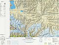 Map including Tingri (T'ing-jih) (DMA, 1981)


References
Further reading
Wikiwand - on
Seamless Wikipedia browsing. On steroids.