Shuanghu County
County in Tibet, China From Wikipedia, the free encyclopedia
Shuanghu County (Chinese: 双湖县), also transliterated from Tibetan as Tsonyi County[3][4][5] or Co Nyi County[6][7] (Tibetan: མཚོ་གཉིས་རྫོང་།; Chinese: 错尼县), is a county under the jurisdiction of the prefecture-level city of Nagqu, in the northernmost part of the Tibet Autonomous Region, China. It was formed in 2012, combining the territory of the former Shuanghu Special District (Chinese: 双湖特别区, Tibetan: མཚོ་གཉིས་དམིགས་བསལ་སྲིད་འཛིན་ཁུལ་) with the eastern half of Nyima County. Much of the county is within the Changtang area.
Shuanghu County
双湖县 • མཚོ་གཉིས་རྫོང་། Tsonyi, Co Nyi | |
|---|---|
 Location of Shuanghu County (light yellow, #FFFF31) in Nagqu | |
 Shuanghu Location of the seat in the Tibet Autonomous Region  Shuanghu Shuanghu (China) | |
| Coordinates: 33°11′32″N 88°50′10″E | |
| Country | China |
| Autonomous region | Tibet |
| Prefecture-level city | Nagqu |
| County seat | Domar Township |
| Area | |
• Total | 116,440.91 km2 (44,958.09 sq mi) |
| Elevation | 4,960 m (16,270 ft) |
| Population (2020)[2] | |
• Total | 10,881 |
| • Density | 0.093/km2 (0.24/sq mi) |
| Time zone | UTC+8 (China Standard) |
| Website | www |
| Shuanghu County | |||||||
|---|---|---|---|---|---|---|---|
| Chinese name | |||||||
| Simplified Chinese | 双湖县 | ||||||
| Traditional Chinese | 雙湖縣 | ||||||
| |||||||
| Tibetan name | |||||||
| Tibetan | མཚོ་གཉིས་རྫོང་། | ||||||
| |||||||
Both Tibetan and Chinese name translates to "twin lake" or "two lakes", the two lakes referred to as Khangro Lake (khang ro tshwa kha) and Rêjo Lake (re co tshwa kha) respectively. Shuanghu County is at very high elevation, mostly above 5,000 meters above sea level, and very sparsely populated (averaging around 0.12 people per square kilometre, but concentrated in the southern portion of the county). The vast majority of its population practices nomadic pastoralism (mostly goats and sheep).[8] The climate is very rough, cold and dry. There is a weather station in Shuanghu, established in 1999,[9] which on average measures negative temperatures (Celsius scale) throughout the year. The highest temperature on record is +2.3 °C (July 2000), the lowest −62.4 °C (January 2006).
Administrative divisions
The county has one town and six townships:
| Name | Chinese | Hanyu Pinyin | Tibetan | Wylie |
|---|---|---|---|---|
| Town | ||||
| Cozhêlhoma Town (Codrel Lhoma, Soggarluma) |
措折罗玛镇 | Cuòzhéluómǎ zhèn | ཚོ་འབྲེལ་ལྷོ་མ་གྲོང་རྡལ། | tsho 'bral lho ma grong rdal |
| Townships | ||||
| Zhide Township (Xibdê) |
协德乡 | Xiédé xiāng | ཞི་བདེ་ཤང་། | zhi bde shang |
| Yachu Township | 雅曲乡 | Yǎqǔ xiāng | ཡ་ཆུ་ཤང་། | ya chu shang |
| Garco Township | 嘎措乡 | Gācuò xiāng | དཀར་མཚོ་ཤང་། | dkar mtsho shang |
| Tsodrel Jangma Township | 措折强玛乡 | Cuòzhéqiángmǎ xiāng | ཚོ་སྦྲེལ་བྱང་མ་ཤང་། | mtsho sbrel byang ma shang |
| Cozhêdangma Township (Tsodrel Jangma) |
措折强玛乡 | Cuòzhéqiángmǎ xiāng | ཚོ་སྦྲེལ་བྱང་མ་ཤང་། | mtsho sbrel byang ma shang |
| Domar Township | 多玛乡 | Duōmǎ xiāng | རྡོ་དམར་ཤང་། | rdo dmar shang |
| Parling Township | 巴岭乡 | Bālǐng xiāng | བར་གླིང་ཤང་། | bar gling shang |
Gallery
 Location of Shuanghu Special District (outdated map, situation before 2012)
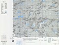
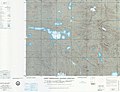
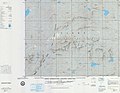
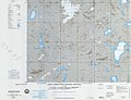
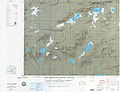
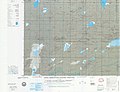
 Map including northern Shuanghu and surrounding region (DMA, 1975)


See also
References
External links
Wikiwand - on
Seamless Wikipedia browsing. On steroids.