Ridderkerk
Town and municipality in South Holland, Netherlands From Wikipedia, the free encyclopedia
Ridderkerk (Dutch pronunciation: [ˌrɪdərˈkɛr(ə)k] ⓘ) is a town and municipality in the western Netherlands, in the province of South Holland. The municipality had a population of 46,671 in 2021 and covers an area of 25.26 km2 (9.75 sq mi) of which 1.54 km2 (0.59 sq mi) is covered by water.
Ridderkerk | |
|---|---|
Town and municipality | |
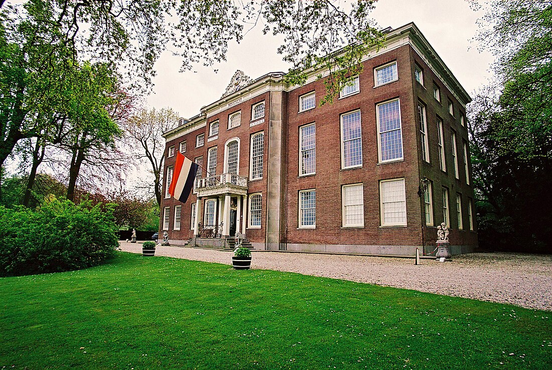
 Huys ten Donck | |
 Location in South Holland | |
| Coordinates: 51°52′N 4°36′E | |
| Country | Netherlands |
| Province | South Holland |
| Government | |
| • Body | Municipal council |
| • Mayor | Marco Oosterwijk (SGP) |
| Area | |
• Total | 25.26 km2 (9.75 sq mi) |
| • Land | 23.72 km2 (9.16 sq mi) |
| • Water | 1.54 km2 (0.59 sq mi) |
| Elevation | −1 m (−3 ft) |
| Population (January 2021)[4] | |
• Total | 46,671 |
| • Density | 1,968/km2 (5,100/sq mi) |
| Demonym | Ridderkerker |
| Time zone | UTC+1 (CET) |
| • Summer (DST) | UTC+2 (CEST) |
| Postcode | 2980–2989 |
| Area code | 0180, 078(Oostendam) |
| Website | www |
The municipality of Ridderkerk also includes the following towns, villages and townships: Bolnes, Oostendam, Rijsoord and Slikkerveer.
Ridderkerk has a museum called De Oudheidkamer, covering the history of the town. The centre of Ridderkerk has a central square for events and there is a theater.
Public transport
- Waterbus
- At the Waterbus stop "de Schans" you can board the number 20 Waterbus to Dordrecht, Papendrecht, Hendrik Ido Ambacht, Alblasserdam, Krimpen aan den IJssel or Rotterdam.
- At the Waterbus stop "de Schans" you can also take line 6 to: Krimpen aan de Lek and Kinderdijk.
- Buses
- The bus services are mostly operated by RET and they go to Rotterdam, Barendrecht and Dordrecht. There are two Arriva bus services to Zwijndrecht and Hendrik Ido Ambacht.

Notable people


- Leen van der Waal (1928–2020), politician, former Member of the European Parliament
- Jan van der Graaf (1937–2022), church administrator
- Rien Kaashoek (born 1937), mathematician and academic
- Luuk Kroon (1942–2012), naval officer, Commander of the Royal Netherlands Navy 1995-1998
- Bas Belder (born 1946), politician, former Member of the European Parliament
- Lee Towers (born 1946), singer
- Gert Oostindie (born 1955), historian and professor[5]
- Martin van Beek (1960–2018), politician, former senator
- Robbert Dijkgraaf FRSE (born 1960), mathematical physicist and politician, string theorist and minister
- Jos Wienen (born 1960), politician, former alderman of Ridderkerk, mayor of Haarlem
- Johan Schot CBE (born 1961), historian working on science and technology policy
- Cora van Nieuwenhuizen (born 1963), politician, former minister
- Flora Lagerwerf-Vergunst (born 1964), judge and politician, former senator
- Bart Jan Spruyt (born 1964), historian, journalist and conservative writer
- Liesbeth Zegveld (born 1970), lawyer, legal expert and professor
- André Flach (born 1976), Dutch politician
Sport
- Gerrit Lagendijk (1941–2010), professional football player and agent
- Wietske de Ruiter (born 1970), female former field hockey striker, team bronze medallist at the 1996 Summer Olympics
- Maurice Lim (born 1984), figure skating champion
- Jordy Buijs (born 1988), footballer, over 250 club caps
- Kevin Strootman (born 1990), footballer, nearly 300 club caps
- Bart Deurloo (born 1991), male artistic gymnast
- Tim Eekman (born 1991), professional footballer, almost 200 club caps
- Mick van Buren (born 1992), footballer, 150 club caps
Gallery
- Ridderkerk in 1584
- Ridderkerk Kerksingel
- Ridderkerk, church: Singelkerk Sint Joris
- Ridderkerk kunstwerk motorrijder
- Ridderkerk kunstwerk ontmoetingspoort
References
External links
Wikiwand - on
Seamless Wikipedia browsing. On steroids.


