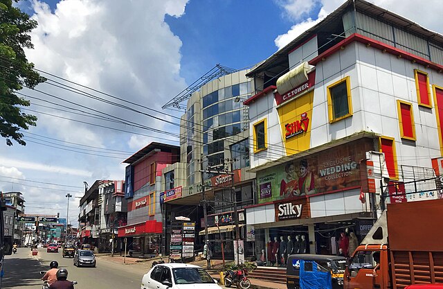
Pattambi
Municipality in Kerala, India From Wikipedia, the free encyclopedia
Pattambi is a town, tehsil, and municipality in the Palakkad District of Kerala, India.[1] It is also the administrative headquarters of the Pattambi Taluk.


Pattambi | |
|---|---|
Municipality | |
 Pattambi Bridge | |
| Coordinates: 10.8057°N 76.1957°E | |
| Country | India |
| State | Kerala |
| District | Palakkad District |
| Government | |
| • Body | Pattambi Municipality |
| • M.L.A | Muhammed Muhsin |
| • M.P. | V. K. Sreekandan |
| Area | |
• Total | 15.84 km2 (6.12 sq mi) |
| Elevation | 63 m (207 ft) |
| Population (2011) | |
• Total | 28,632 |
| • Density | 1,800/km2 (4,700/sq mi) |
| Languages | |
| • Official | Malayalam |
| Time zone | UTC+5:30 (IST) |
| PIN | 679 303 |
| Telephone code | 91466 |
| Vehicle registration | KL-52 |
| Sex ratio | 0.96 ♂/♀ |
| Literacy | 83% |
| Parliament constituency | Palakkad |
| Assembly constituency | Pattambi |
History
Pattambi was originally a part of the Nedunganad Swaroopam dynasty, which was ruled by Nedungadis, who held sway over a large part of present-day Pattambi and Ottapalam tehsils. By the end of the 15th century CE, Nedunganad came under the leadership of the Zamorin of Calicut, who was also the main ruler of the South Malabar region. The Zamorin appointed his local chieftain at Kavalappara Kovilakam to rule this area. It was a part of the Walluvanad taluk in the Malappuram Revenue Division of the Malabar District during the British Raj,[2] and later became part of the Ottapalam taluk. Now Pattambi is the headquarters of Pattambi Taluk, formed on 23 December 2013.[3]
Demographics

Religion in Pattambi (2011)[4]
- Islam (55.34%)
- Hinduism (43.73%)
- Christianity (0.86%)
- Other (0.07%)
In the 2011 census of India, the total population of Pattambi Village Panchayat was recorded to be 28,632.[5]
- 14,049 males (49%); 14,583 females (51%).
- Number of households: 5,897
- Scheduled Caste population: 3,471 (12%)
- Scheduled Tribe population: 37 (0% ).
- In the age group 0–6 years: 3,534 (males: 1,837, females: 1,697)
- Literacy: 83% (23,888 literates and 4,744 illiterates)
- 8,561 individuals were employed. It includes 1,657 people with irregular employment.

Notable people
See also
References
Wikiwand - on
Seamless Wikipedia browsing. On steroids.


