Navuluru
Neighbourhood in Guntur, Andhra Pradesh, India From Wikipedia, the free encyclopedia
Neighbourhood in Guntur, Andhra Pradesh, India From Wikipedia, the free encyclopedia
Navuluru (నవులూరు) is a neighbourhood and a part of Urban Notified Area of Amaravati, the state capital of the Indian state of Andhra Pradesh.[4] It was an out growth of Mangalagiri Municipality in Guntur district, prior to its merger in the urban area of the state capital.[5][6]
Navuluru
నవులూరు Nowlur | |
|---|---|
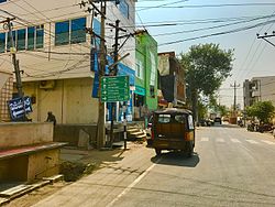
 Board showing Directions to Yerrabalem | |
| Coordinates: 16°26′37″N 80°33′28″E | |
| Country | India |
| State | Andhra Pradesh |
| District | Guntur |
| Mandal | Mangalagiri |
| Area | |
| • Total | 250 km2 (100 sq mi) |
| Population | |
| • Total | 24,861 |
| • Density | 99/km2 (260/sq mi) |
| Languages | |
| • Official | Telugu |
| Time zone | UTC+5:30 (IST) |
| PIN | 522502 |
Navuluru is located at 16.4443°N 80.5383°E.
As of 2011[update] census, Navuluru had a population of 24,861. The total population constitute, 12,431 males and 12,430 females —a sex ratio of 999 females per 1000 males. 2,598 children are in the age group of 0–6 years, of which 1,321 are boys and 1,277 are girls. The average literacy rate stands at 68.19% with 15,180 literates, significantly higher than the state average of 67.41%.[1]
Mangalagiri is the nearest railway station to the out growth.
Seamless Wikipedia browsing. On steroids.
Every time you click a link to Wikipedia, Wiktionary or Wikiquote in your browser's search results, it will show the modern Wikiwand interface.
Wikiwand extension is a five stars, simple, with minimum permission required to keep your browsing private, safe and transparent.