Mahananda River
River in Bangladesh and India From Wikipedia, the free encyclopedia
The Mahananda (/məˌhɑːˈnʌndə, ˌmɑːhə-/ mə-HAH-NUN-də, MAH-hə-) is a trans-boundary river that flows through the Indian states of Bihar and West Bengal before crossing into Bangladesh. It is an important tributary of the Ganges.
| Mahananda River Môhānôndā Nôdi (Bengali) | |
|---|---|
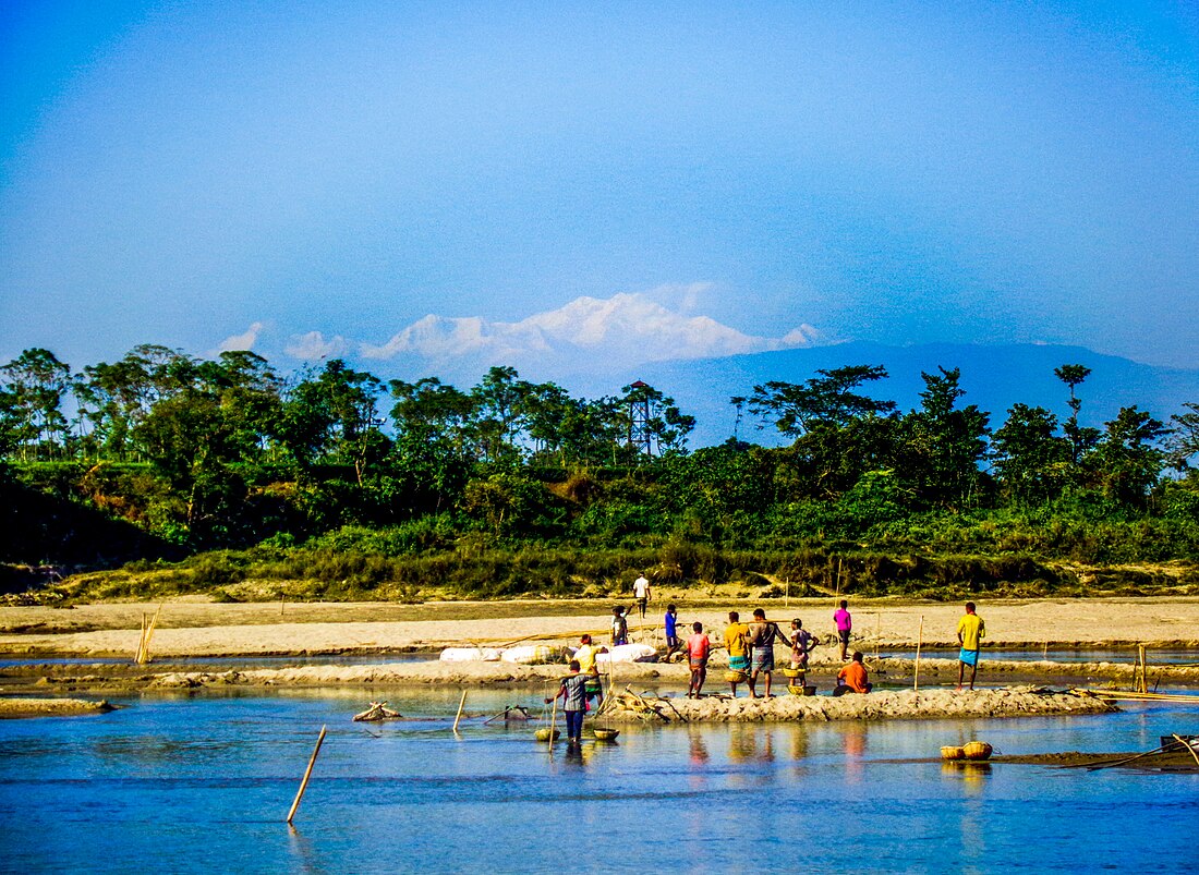
 People collecting stone at Mahananda River in Tetulia, Panchagarh District, Bangladesh with Kangchenjunga in the background | |
 | |
| Location | |
| Countries | India and Bangladesh |
| States | West Bengal (India) Bihar (India) |
| Divisions | Rangpur (Bangladesh) Rajshahi (Bangladesh) |
| Districts | Darjeeling (India), Jalpaiguri (India) Uttar Dinajpur (India) Kishanganj (India) Purnia (India) Katihar (India) Malda (India) Panchagarh (Bangladesh) Nawabganj (Bangladesh) |
| Cities | Kurseong (India) Siliguri (India) English Bazar(India) Godagiri (Bangladesh) |
| Physical characteristics | |
| Source | Paglajhora Falls, Darjeeling hills in the Himalayas |
| Mouth | Ganges |
• location | Godagari, Rajshahi District, Bangladesh |
• coordinates | 24°29′24″N 88°18′14″E |
| Length | 360 km (220 mi) |
| Basin size | 20,600 km2 (8,000 sq mi) |
| Basin features | |
| Tributaries | |
| • left | Tangon River, Nagar River (Rangpur) |
| • right | Mechi River, Kankai River, Balason River, Kalindi River |
Course
Summarize
Perspective

The Mahananda river system consists of two streams- one is locally known as Fulahar river and the other Mahananda.[1] The Fulahar originates in the Himalayas in Nepal and traverses through the Indian state of Bihar and merges with the Ganges in left opposite to Rajmahal.[2] The Mahananda originates in the Himalayas: Paglajhora Falls on Mahaldiram Hill near Chimli, east of Kurseong in Darjeeling district at an elevation of 2,100 metres (6,900 ft).[3][4][5] It flows through Mahananda Wildlife Sanctuary and descends to the plains near Siliguri. It touches Jalpaiguri district.[4][6]
It enters Bangladesh near Tentulia in Panchagarh District, flows for 3 kilometres (1.9 mi) after Tentulia and returns to India.[7] After flowing through Uttar Dinajpur district in West Bengal and Kishanganj, Purnia and Katihar districts in Bihar, it enters Malda district in West Bengal.[8][9] The Mahananda divides the district into two regions — the eastern region, consisting mainly of old alluvial and relatively infertile soil is commonly known as Barind (Barendrabhumi), and the western region, which is further subdivided by the river Kalindri into two areas, the northern area is known as "Tal". It is low-lying and vulnerable to inundation during rainy season; the southern area consists of very fertile land and is thickly populated, being commonly known as "Diara".[10]
It joins the Ganges at Godagari in Rajshahi district in Bangladesh.[3]
Basin data
The total length of the Mahananda is 360 kilometres (220 mi),[11] out of which 324 kilometres (201 mi) are in India and 36 kilometres (22 mi) are in Bangladesh.
The total drainage area of the Mahananda is 20,600 square kilometres (8,000 sq mi) out of which 11,530 square kilometres (4,450 sq mi) are in India.[3]
Tributaries
The main tributaries of the Mahananda are Balason, Mechi, Kankai[3] and River Kalindri. At the East of the confluence of the Kalindri and the Mahananda lies the Old Malda town. In the Siliguri area it has three tributaries called the Trinai, Ranochondi and the pair of Chokor and Dauk taken as a single tributary.[4]
References
External links
Wikiwand - on
Seamless Wikipedia browsing. On steroids.
