Kupwara district
District of Jammu and Kashmir administered by India From Wikipedia, the free encyclopedia
Kupwara district is an administrative district of Indian-administered Jammu and Kashmir in the disputed Kashmir region.[1] It is one of the 10 districts located in the Kashmir Valley Division of Indian administered Kashmir. The Pohru River (originating in Lolab Valley and flowing from east to west) and Mawar river are two main rivers in the district. Both of them meet Jhelum river in Baramulla district.[9]
Kupwara district
Kopwor | |
|---|---|
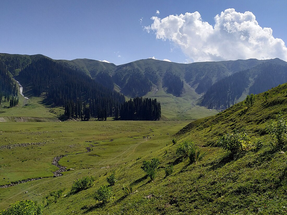
 Bangus Valley in Kupwara | |
 Interactive map of Kupwara district | |
 Kupwara district is in Indian-administered Jammu and Kashmir in the disputed Kashmir region[1] It is in the Kashmir division (bordered in neon blue). | |
| Coordinates (Kupwara): 34°37′N 74°13′E | |
| Administering country | India |
| Union Territory | Jammu and Kashmir |
| Division | Kashmir Division |
| Established | 1979 |
| Headquarters | Kupwara |
| Government | |
| • Lok Sabha Constituency | Baramulla |
| • MP[2] | Engineer Rashid |
| • Vidhan Sabha Constituencies | 6 : Karnah, Trehgam, Kupwara, Lolab, Handwara and Langate |
| Area | |
• Total | 2,379 km2 (919 sq mi) |
| • Urban | 47.3 km2 (18.3 sq mi) |
| • Rural | 2,331.7 km2 (900.3 sq mi) |
| Population | |
• Total | 870,354 |
| • Density | 370/km2 (950/sq mi) |
| • Urban | 104,729 |
| • Rural | 765,625 |
| Demographics | |
| • Literacy[6] | 64.51% |
| • Sex ratio[6] | 835 ♀/ 1000 ♂ |
| Languages | |
| • Official | Kashmiri, Urdu, Hindi, Dogri, English |
| Time zone | UTC+05:30 (IST) |
| Vehicle registration | JK-09 |
| Major highways | NH 701 |
| Website | kupwara |
History
The district was carved out of the erstwhile Baramulla district in 1979 with Kupwara Town as the district headquarters.[10]
Kupwara district, located in the northern part of Jammu and Kashmir, India, has a rich and complex history shaped by its strategic location and diverse cultural influences.
- Bomba Tribe: The Bomba, also spelled Bambas or Bhambas, are a Rajput tribe found in both Pakistani-administered Azad Jammu and Kashmir and Indian-administered Jammu and Kashmir. They claim descent from Arab tribes but are more likely descendants of the indigenous Khas people who inhabited the Karnah region. The Bomba clan ruled Karnah until the Sikh conquest of Kashmir in the early 19th century. Sultan Muzaffar Khan Bomba established the city of Muzaffarabad in present-day Azad Kashmir. The last Bomba ruler, Sultan Sher Ahmed Khan Bomba, was defeated by Dogra ruler Maharaja Ranbir Singh at Panzgam, Kupwara (Keran-Karnah), in the early 19th century.
Geography
Kupwara district has a total area of 2,379 square kilometres (919 sq mi). The district is bordered by Bandipora district in the east, Baramulla district to the south and Pakistan administered Jammu and Kashmir to the north and west. The district is mostly rural/agricultural.
Adjacent districts
- Bandipora district, Indian administered Kashmir – east
- Neelum district, Pakistan administered Jammu and Kashmir – northeast
- Neelum district, Pakistan administered Jammu and Kashmir – northwest
- Muzaffarabad district and Hattian Bala district, Pakistan administered Jammu and Kashmir – west
- Baramulla district, Indian administered Kashmir – south
Economy
Most of the people depend on agriculture and horticulture. There is a good production and business of walnuts in Kupwara.[11]
The Department of horticulture have developed a high density walnut nursery in Kupwara.[12]
Demographics
Summarize
Perspective
| Year | Pop. | ±% p.a. |
|---|---|---|
| 1901 | 110,979 | — |
| 1911 | 124,744 | +1.18% |
| 1921 | 137,936 | +1.01% |
| 1931 | 153,758 | +1.09% |
| 1941 | 170,079 | +1.01% |
| 1951 | 187,076 | +0.96% |
| 1961 | 204,073 | +0.87% |
| 1971 | 257,824 | +2.37% |
| 1981 | 328,743 | +2.46% |
| 1991 | 465,948 | +3.55% |
| 2001 | 650,393 | +3.39% |
| 2011 | 870,354 | +2.96% |
| source:[13] | ||
According to the 2011 census Kupwara district has a population of 870,354.[4] This gives it a ranking of 470th in India (out of a total of 640). The district has a population density of 368 inhabitants per square kilometre (950/sq mi). Its population growth rate over the decade 2001–2011 was 34.62%. Kupwara has a sex ratio of 843 females for every 1000 males (this varies with religion), and a literacy rate of 75.60% Scheduled Castes and Scheduled Tribes make up 0.12% and 8.08% of the population respectively.[citation needed]
| Sex Ratio in Kupwara District in 2011 Census. (no. females per 1,000 males) | ||||
|---|---|---|---|---|
| Religion (and population) | Sex Ratio | |||
| Muslim (pop 823,286) | 912 | |||
| Hindu (pop 37,128) | 30 | |||
| Sikh (pop 5,600) | 162 | |||
| Other (pop 1,818) | 395 | |||
| Not stated (pop 2,522) | 695 | |||
| Total (pop 870,354) | 835 | |||
| Kupwara district: religion, gender ratio, and % urban of population, according to the 2011 Census.[5] | |||||||||
|---|---|---|---|---|---|---|---|---|---|
| Hindu | Muslim | Christian | Sikh | Buddhist | Jain | Other | Not stated | Total | |
| Total | 37,128 | 823,286 | 1,700 | 5,600 | 66 | 39 | 13 | 2,522 | 870,354 |
| 4.27% | 94.59% | 0.20% | 0.64% | 0.01% | 0.00% | 0.00% | 0.29% | 100.00% | |
| Male | 36,057 | 430,521 | 1,215 | 4,821 | 51 | 28 | 9 | 1,488 | 474,190 |
| Female | 1,071 | 392,765 | 485 | 779 | 15 | 11 | 4 | 1,034 | 396,164 |
| Gender ratio (% female) | 2.9% | 47.7% | 28.5% | 13.9% | 22.7% | 28.2% | 30.8% | 41.0% | 45.5% |
| Sex ratio (no. of females per 1,000 males) |
30 | 912 | 399 | 162 | – | – | – | 695 | 835 |
| Urban | 9,460 | 93,355 | 369 | 1,123 | 20 | 6 | 8 | 388 | 104,729 |
| Rural | 27,668 | 729,931 | 1,331 | 4,477 | 46 | 33 | 5 | 2,134 | 765,625 |
| % Urban | 25.5% | 11.3% | 21.7% | 20.1% | 30.3% | 15.4% | 61.5% | 15.4% | 12.0% |
At the time of the 2011 census, 71.11% of the population spoke Kashmiri, 14.12% Pahari, 9.21% Gujari and 2.70% Hindi as their first language. Urdu is widely-spoken as a second language.[4]
Notable people
- Anwar Shah Kashmiri, Renowned Islamic scholar from Kashmir, known for his expertise in hadith, fiqh, and theology. A key figure at Darul Uloom Deoband.
- Aadil Manzoor Peer, Stock athlete who has represented India internationally with his right-hand playing style.
- Abdul Gani Lone, Kashmiri separatist leader, founder of People’s Conference, assassinated in 2002 for his moderate views.
- Ali Mohammad Shahbaz, Kashmiri poet, satirist, humanist, and philanthropist, whose work focused on the Kashmir conflict.
- Ashraf Sehrai, Separatist leader and chairman of Tehreek-e-Hurriyat, elected after Syed Ali Shah Geelani’s resignation.
- Engineer Rashid, Kashmiri politician, founder of Awami Itihad Party, and an advocate for Kashmir’s autonomy and self-determination.
- Maqbool Bhat , Kashmiri separatist leader, founder of NLF(JKLF), and was hanged in 1984 for his activism.
- Sajad Gani Lone, Kashmiri politician, leader of the Jammu and Kashmir Peoples Conference, and former minister in the region’s government.
- Shah Faesal, Former IAS topper and founder of Jammu and Kashmir People’s Movement.
- Mir Mohammad Fayaz, Formar Rajhya Sabha MP of India, and current MLA of kupwara constituency, Mir Mohammad Fayaz started and made a great infrastructure developments and made the progress by making the Kupwara district on India's well known district.
Transportation
Air
The nearest airport is Sheikh ul-Alam International Airport in Srinagar located 87 kilometres from district headquarters Kupwara. There are plans to construct an airport in Panzgam.[15]
Rail
Kupwara district is not yet connected to railways. There are plans to extend the Jammu–Baramulla line up to Kupwara in the near future.[16] The nearest railway station is Baramulla railway station located 45 kilometres from Kupwara.
Road
Kupwara is well-connected with roads and highways. The NH 701 passes through Kupwara district alongside other intra-district roads.
See also
References
External links
Wikiwand - on
Seamless Wikipedia browsing. On steroids.
