Top Qs
Timeline
Chat
Perspective
Kon Tum
Provincial city in Vietnam From Wikipedia, the free encyclopedia
Remove ads
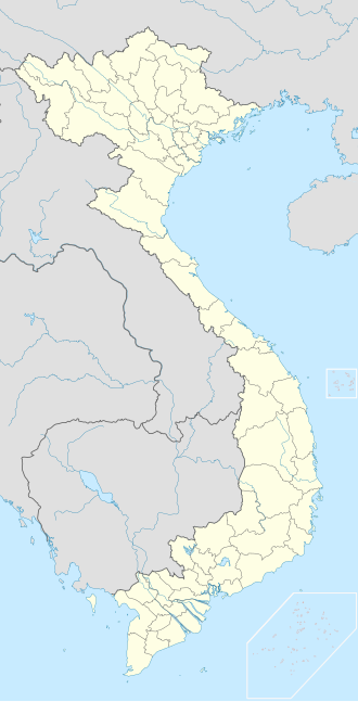
Kon Tum is a city in Quảng Ngãi Province in Vietnam. It is located inland in the Central Highlands region of Vietnam, near the borders of Laos and Cambodia.
Historically, this area has been inhabited by the indigenous Ba Na people, which led to the name Kon Tum, meaning "Village by the Lake" in the Ba Na language. Its unique location features flat and fertile land, enriched by the Dak Bla River, and a convergence of various ethnic groups over time. Among these, the Kinh people, hailing from provinces such as Quang Nam, Quang Ngai, and Binh Dinh, have settled here. In the years 1841-1850, French missionaries, en route to the Central Highlands, established the first Christian mission in this region. By 1893, the colonial French authorities established the Kon Tum administrative agency, headed by Father Vialleton, and from that point, the name Kon Tum became officially used. Subsequently, the provincial administrative unit adopted this name. Kon Tum City, once a sparsely populated and desolate area, has evolved into a hub for settlement, commerce, and governance throughout the province's rich history. Currently, Kon Tum City holds the status of Class-2 Provincial City.
Prior to Vietnam's 2025 administrative reforms, Kon Tum was the capital of the formerly Kon Tum province making Quảng Ngãi the now capital city of the new Quảng Ngãi province after merging with Kon Tum province.
Remove ads
Geography
Summarize
Perspective
Kon Tum City is situated in the southern part of Kon Tum Province, within a basin landscape at an elevation of approximately 525 meters above sea level. It is encircled by the Dak Bla River valley. The city is located 547 kilometers north of Ho Chi Minh City, 292 kilometers south of Da Nang, and 1,087 kilometers south of the capital Hanoi. Additionally, it is 50 kilometers from Pleiku and 229 kilometers from Buon Ma Thuot. Kon Tum City shares its geographical boundaries as follows:
- To the east, it borders Kon Ray District.
- To the west, it borders Sa Thay District.
- To the south, it shares borders with Chu Pah District in Gia Lai Province.
- To the north, it borders Dak Ha District.
The city covers an area of 433 square kilometers and had a population of 205,762[2] people in the year 2021, with a population density of 475 people per square kilometer.
In 2019, Kon Tum City had a land area of 432.98 square kilometers and a population of 168,264 people. Among these, 102,051 residents lived in urban areas, constituting 61% of the population, while 66,213 people resided in rural areas, making up the remaining 39%. The population density in the city was approximately 389 people per square kilometer.
Kon Tum City is home to 20 different ethnic groups living together.
Remove ads
Chu Hreng Mountain
Chu Hreng mountain range is located in the south of Kon Tum city with a total length of about 11km, the mountain direction runs in the Northwest - Southeast direction, starting from Kon K'Tu Village, Dak Ro Wa commune and ending. Ending at Sao Mai Pass, Hoa Binh commune, Kon Tum city, adjacent to Chu Pao mountain range in Ia Khui commune, Chu Pah district, Gia Lai province. Mostly along the top of the mountain range is the administrative boundary between Gia Lai and Kon Tum provinces. Chu Hreng Mountain has the highest point equivalent to 1,152m above sea level.[3]
Remove ads
History
After the People's Army of Vietnam invaded South Vietnam on March 30, 1972 during the Easter Offensive, two divisions attempted to capture Kon Tum, but failed. In March 1975, however, Kon Tum was overrun during the Ho Chi Minh Campaign and large numbers of refugees were forced to flee east to the south central coast.
Kon Tum has several vestiges of the French colonial period, as well as several tribal villages directly in the suburbs of the Vietnamese-reconstructed town. Among the town's landmarks, there is a Roman Catholic wooden church on discrete stilts and a large French-built seminary which hosts a small museum on local hill tribes. French missionary presence in Kon Tum traces back to 1851.
Climate
Summarize
Perspective
Kon Tum has a tropical savanna climate (Köppen Aw) with a wet season from April to November, a dry season from November to April, and consistently very warm-to-hot temperatures with high-to-oppressive humidity year-round.
Remove ads
References
External links
Wikiwand - on
Seamless Wikipedia browsing. On steroids.
Remove ads


