Loading AI tools
Galiyakot is a town in Dungarpur District of Rajasthan, India.[1] It is situated about 56 km from Dungarpur city and 168km from the Rajasthan city of Udaipur. It was controlled by the Parmar dynasty around Vikram Samvat 1000. In Vikram Samvat 1342, Rao Dedu (Devpal) Raja of the Sisodiya dynasty subdued Galiyakot. The predecessors of Dungarpur controlled Galiyakot for many years and settled in Dungarpur. It is part of a Dawoodi Bohra pilgrimage site. It contains many Hindu temples, and is famous for the Shitla Mata Mandir and the tomb of Babjee Moula Syedi Fakhruddin.
This article has multiple issues. Please help improve it or discuss these issues on the talk page. (Learn how and when to remove these template messages)
|
Galiyakot
Wagad Taherabad | |
|---|---|
| Galiyakot | |
 Galiyakot Location in Rajasthan, India  Galiyakot Galiyakot (India) | |
| Coordinates: 23.536°N 74.009°E | |
| Country | |
| State | Rajasthan |
| District | Dungarpur |
| Elevation | 145 m (476 ft) |
| Population (2001) | |
| • Total | 6,636 |
| Languages | |
| • Official | Hindi, Rajasthani, wagdhi |
| Time zone | UTC+5:30 (IST) |
| ISO 3166 code | RJ-IN |
Galiakot is located at 23.536°N 74.009°E. It has an average elevation of 145 metres (475 feet).
As of 2001[update] India census, Galiakot had a population of 6,636.[2] Males constitute 51% of the population and females 49%. Galiakot has an average literacy rate of 56%, lower than the national average of 59.5%: male literacy is 67%, and female literacy is 44%. In Galiakot, 17% of the population is under 6 years of age. This place was also known or famous for Ramkada udhyog.
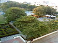 Gardens Fakhri Mazar
 Residential complex 2


Wikiwand in your browser!
Seamless Wikipedia browsing. On steroids.
Every time you click a link to Wikipedia, Wiktionary or Wikiquote in your browser's search results, it will show the modern Wikiwand interface.
Wikiwand extension is a five stars, simple, with minimum permission required to keep your browsing private, safe and transparent.