Dharanikota
Village in Andhra Pradesh, India From Wikipedia, the free encyclopedia
Dharanikota is a village in Palnadu district of the Indian state of Andhra Pradesh. It is the site of ancient Dhanyakataka, which was the capital of the Satavahana dynasty that ruled in the Deccan around the 1st to 3rd centuries CE.
Dharanikota
Dhanyakatakam | |
|---|---|
Village | |
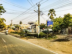
 Residential area in Dharanikota | |
| Nickname: Dhannakada | |
 Dynamic map | |
| Coordinates: 16.5783°N 80.3482°E | |
| Country | India |
| State | Andhra Pradesh |
| District | Palnadu |
| Mandal | Amaravathi mandal |
| Government | |
| • Type | Panchayati raj |
| • Body | Dharanikota Gram Panchayat |
| Area | |
• Total | 3,548 km2 (1,370 sq mi) |
| Population (2011)[3] | |
• Total | 7,534 |
| • Density | 2.1/km2 (5.5/sq mi) |
| Languages | |
| • Official | Telugu |
| Time zone | UTC+5:30 (IST) |
| PIN | 522436 |
| Area code | +91–8640 |
| Vehicle registration | AP |
Dharanikota is located in Amaravathi mandal of Sattenapalli revenue division.[2][4] The village forms a part of Andhra Pradesh Capital Region, under the jurisdiction of APCRDA.[5]
History

Archaeological excavations at Dharanikota revealed viharas in Dharanikota and nearby areas.[6] It is the site of ancient Dhanyakataka, which was the capital of the Satavahana dynasty that ruled in the Deccan around the 1st to 3rd centuries CE. It was also the capital of the Kota Vamsa, which ruled during the medieval period until the mid-12th century. The Krishna River Valley is an important rice-producing area. It was also an important centre of trade with other parts of India and foreign countries. The place is also famous for the great Amaravati stupa; a very large Kalachakra ceremony was conducted there by the Dalai Lama in January, 2006.[7][8] Xuanzang reportedly visited Dharanikota and the Amaravati stupa and wrote an enthusiastic account of the place and the viharas that existed then.[9] Jainism flourished in Dharanikota during the reign of Sada kings.[10]
Geography
Dharanikota is situated to the west of the mandal headquarters, Amaravathi,[11] at 16.579444°N 80.311111°E. It is spread over an area of 1,524 ha (3,770 acres).[2]
Demographics
As of 2011[update] Census of India, Dharanikota had a population of 7,534. The total population constitute, 3,734 males and 3,800 females —a sex ratio of 1018 females per 1000 males. 725 children are in the age group of 0–6 years, of which 368 are boys and 357 are girls —a ratio of 970 per 1000. The average literacy rate stands at 66.06% with 4,498 literates, slightly lower than the state average of 67.41%.[3][12]
Government and politics
Dharanikota Gram Panchayat is the local self-government of the village.[1] It is divided into wards and each ward is represented by a ward member.[13] The village is administered by the Amaravathi Mandal Parishad at the intermediate level of panchayat raj institutions.[11]
Education
As per the school information report for the academic year 2018–19, the village has a total of eight schools. These schools include five MPP and three private schools.[14]
References
Wikiwand - on
Seamless Wikipedia browsing. On steroids.


