Ballari
City in Karnataka, India From Wikipedia, the free encyclopedia
City in Karnataka, India From Wikipedia, the free encyclopedia
Ballari (formerly Bellary[6]) in the eponymous Ballari district, is a city in the state of Karnataka, India. Bellari houses many steel plants such as JSW Vijayanagar, one of the largest in Asia.
This article needs additional citations for verification. (March 2022) |
Ballari | |
|---|---|
 Ballari city | |
 Ballari in Karnataka | |
| Coordinates: 15°06′N 76°55′E | |
| Country | |
| State | |
| District | Ballari |
| Government | |
| • Type | Municipal Corporation |
| • Body | Ballari City Corporation |
| • Mayor | Shwetha B |
| • Commissioner | G Khaleel Sab[1] |
| Area | |
| • City | 167.38 km2 (64.63 sq mi) |
| • Rural | 1,609.68 km2 (621.50 sq mi) |
| Elevation | 485 m (1,591 ft) |
| Population (2011) | |
| • City | 410,445 [2] |
| • Rank | 95th (India) 5th (Karnataka) |
| • Rural | 360,484 |
| Demonym | Ballarians |
| Time zone | UTC+05:30 (IST) |
| Postal Index Number | 583101, 583102, 583103, 583104, 583105, 583152[3] |
| Telephone code | (+91)8392 |
| ISO 3166 code | IN-KA |
| Vehicle registration | KA-34 |
| Official language | Kannada[4] |
| Sex ratio | 1.04[5] ♂/♀ |
| Literacy | 79%[5] |
| Website | ballaricity |


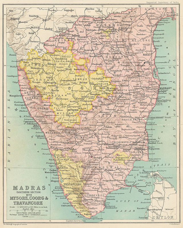
Ballari was a part of Rayalaseema (Ceded Districts) which was part of Madras Presidency till 1 November 1956.
The Ballari city municipal council was upgraded to a city corporation in 2004.[7]
The Union Ministry of Home Affairs of the Government of India approved a proposal[8] to rename the city in October 2014 and Bellary was renamed to "Ballari" on 1 November 2014.[9]

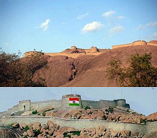
Ballari is located at 15.15°N 76.93°E. The city stands in the midst of a wide, level plain of black cotton soil.[10]Granite rocks and hills form a prominent feature of Ballari. The city is spread mainly around two hills of granite composition, the Ballari Hill and the Kumbara Gudda.
Ballari Hill has a circumference of nearly 2 miles (3.2 km) and a height of 480 feet (150 m). The length of this rock from north-east to south-west is about 1,150 ft (350 m). To the east and south lies an irregular heap of boulders, to the west there is an unbroken monolith, and the north is walled by bare, rugged ridges.[10]
Kumbara Gudda looks like the profile of a human face from the south-east. It is also known as Face Hill.[10]
| Climate data for Bellary (1981–2010, extremes 1901–2012) | |||||||||||||
|---|---|---|---|---|---|---|---|---|---|---|---|---|---|
| Month | Jan | Feb | Mar | Apr | May | Jun | Jul | Aug | Sep | Oct | Nov | Dec | Year |
| Record high °C (°F) | 37.6 (99.7) |
40.5 (104.9) |
43.0 (109.4) |
45.4 (113.7) |
44.6 (112.3) |
44.7 (112.5) |
39.5 (103.1) |
39.0 (102.2) |
38.4 (101.1) |
39.0 (102.2) |
38.4 (101.1) |
35.6 (96.1) |
44.7 (112.5) |
| Mean daily maximum °C (°F) | 31.4 (88.5) |
34.4 (93.9) |
38.1 (100.6) |
40.4 (104.7) |
39.6 (103.3) |
35.3 (95.5) |
32.7 (90.9) |
31.9 (89.4) |
32.3 (90.1) |
31.8 (89.2) |
30.8 (87.4) |
30.2 (86.4) |
34.1 (93.4) |
| Mean daily minimum °C (°F) | 15.6 (60.1) |
18.1 (64.6) |
21.1 (70.0) |
23.9 (75.0) |
24.4 (75.9) |
23.3 (73.9) |
23.0 (73.4) |
22.7 (72.9) |
21.9 (71.4) |
20.9 (69.6) |
18.3 (64.9) |
15.6 (60.1) |
20.7 (69.3) |
| Record low °C (°F) | 7.0 (44.6) |
8.5 (47.3) |
10.0 (50.0) |
13.0 (55.4) |
14.5 (58.1) |
14.8 (58.6) |
15.5 (59.9) |
15.0 (59.0) |
15.0 (59.0) |
12.5 (54.5) |
8.4 (47.1) |
8.0 (46.4) |
7.0 (44.6) |
| Average rainfall mm (inches) | 2.9 (0.11) |
2.3 (0.09) |
6.0 (0.24) |
17.2 (0.68) |
54.3 (2.14) |
59.2 (2.33) |
42.6 (1.68) |
70.0 (2.76) |
111.0 (4.37) |
89.0 (3.50) |
39.5 (1.56) |
5.5 (0.22) |
499.5 (19.67) |
| Average rainy days | 0.5 | 0.2 | 0.6 | 1.5 | 3.4 | 3.8 | 3.8 | 4.7 | 5.4 | 5.8 | 2.4 | 0.5 | 32.7 |
| Average relative humidity (%) (at 17:30 IST) | 43 | 37 | 30 | 29 | 34 | 50 | 56 | 58 | 58 | 62 | 56 | 50 | 47 |
| Source: India Meteorological Department[11][12] | |||||||||||||

| Year | Pop. | ±% |
|---|---|---|
| 1931 | 47,573 | — |
| 1941 | 56,148 | +18.0% |
| 1951 | 70,332 | +25.3% |
| 1961 | 85,673 | +21.8% |
| 1971 | 125,183 | +46.1% |
| 1981 | 201,579 | +61.0% |
| 1991 | 245,391 | +21.7% |
| 2001 | 316,766 | +29.1% |
| 2011 | 410,445 | +29.6% |
| Source: [13] | ||
| Religions in Ballari City (2011)[14] | ||||
|---|---|---|---|---|
| Religion | Percent | |||
| Hinduism | 70.33% | |||
| Islam | 26.53% | |||
| Christianity | 1.71% | |||
| Jainism | 0.79% | |||
| Other or not stated | 0.65% | |||
According to the 2011 Census of India, the urban population of Ballari was 410,445; of whom 206,149 were male and 204,296 female. 280,610 of the population were literate and 52,413 of the population were under 7 years of age.[15] The population in 2001 was recorded as 316,766.[16]
Kannada is the largest language, spoken by 42.06% of the population. Telugu is the second-largest, spoken by 25.03%, and Urdu 24.35%. 3.04% of the population spoke Hindi, 1.75% Marathi and 1.69% Tamil.[16][17]

National Highway 67 (India), National Highway 150A (India), State Highway 128 and State Highway 132 pass through the city.
There is Ballari Junction railway station on the Guntakal–Vasco da Gama section.
The closest functional commercial airport is Jindal Vijaynagar Airport.
See Category:People from Bellary
Seamless Wikipedia browsing. On steroids.
Every time you click a link to Wikipedia, Wiktionary or Wikiquote in your browser's search results, it will show the modern Wikiwand interface.
Wikiwand extension is a five stars, simple, with minimum permission required to keep your browsing private, safe and transparent.