
Puerto Rico Highway 510
Highway in Puerto Rico / From Wikipedia, the free encyclopedia
Dear Wikiwand AI, let's keep it short by simply answering these key questions:
Can you list the top facts and stats about Puerto Rico Highway 510?
Summarize this article for a 10 year old
SHOW ALL QUESTIONS
Puerto Rico Highway 510 (PR-510) is a tertiary[3] highway in southern Puerto Rico. The road runs north to south in a general south-southwestern direction. The road connects PR-1 in Barrio Capitanejo, Ponce, to PR-14 in the town of Juana Díaz. Portions of the Juana Díaz portion of the road were damaged in September 2017 by Hurricane Maria.[4]
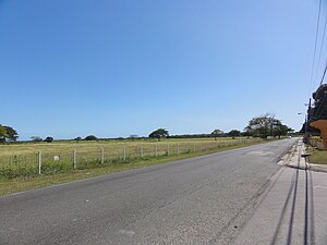 A stretch of PR-510 in Barrio Capitanejo, looking south
.jpg)
Quick Facts Highway 510, Route information ...
Highway 510 | ||||
|---|---|---|---|---|
| Ruta 510 | ||||
| Route information | ||||
| Maintained by Puerto Rico DTPW | ||||
| Length | 10.3 km[1][2] (6.4 mi) | |||
| Major junctions | ||||
| South end | ||||
| Major intersections |
| |||
| North end | ||||
| Location | ||||
| Country | United States | |||
| Territory | Puerto Rico | |||
| Municipalities | Ponce, Juana Díaz | |||
| Highway system | ||||
| ||||
| ||||

Close