Loading AI tools
Oytograk[1][4][5][6] (Uyghur: ئويتوغراق يېزىسى;[7][8] Chinese: 奥依托格拉克乡) is a township in Yutian County (Keriya), Hotan Prefecture, Xinjiang, China.
Oytograk
Aoyituo Gelake | |
|---|---|
 Oytograk Location in Xinjiang | |
| Coordinates: 36°50′24″N 081°55′08″E | |
| Country | China |
| Autonomous Region | Xinjiang |
| Prefecture | Hotan |
| County | Yutian / Keriya |
| Seat | Langanwusitang (兰干吾斯塘村)[1] |
| Village-level divisions | 18 |
| Area | |
| • Total | 3,639 km2 (1,405 sq mi) |
| Population (2010)[2] | |
| • Total | 18,271 |
| • Density | 5.0/km2 (13/sq mi) |
| Ethnic groups | |
| • Major ethnic groups | Uyghur[1][3] |
| Time zone | UTC+8 (China Standard) |
Oytograk (ئويتوغراق) means 'desert poplar forest lowland' in Uyghur, so named because it is located in a lowland surrounded by sand dunes that has many desert poplars.[1]
In 1958, Zhandou Commune (战斗公社) was established.[3][1]
In 1984, Zhandou Commune became Oytograk Township (奥依托拉克乡).[3]
Oytograk is located 22.4 km (13.9 mi) east of the county seat.[2][9] Oytograk is on the northern side of China National Highway 315.[1]
Yeyik includes one residential community, sixteen villages, and one other area:[3][10]
Residential community (Mandarin Chinese Hanyu Pinyin-derived names except where Uyghur is provided):
- Xinjiayuan (新家园社区)
Villages:
- Tawugazi (塔吾尕孜村), Taleke'airike (塔勒克艾日克村), Langanwusitang (meaning 'relay station canal' (驿站渠) in Uyghur;[1] 兰干吾斯塘村), Ya'ermaili (亚尔买里村), Toghraq'östeng (Tuogelawusitang; توغراقئۆستەڭ كەنت[8] / 托格拉吾斯塘村), Kule'airike (库勒艾日克村), Yesiyoulegun (Yesiyou Leguncun;[11] 也斯尤勒滚村) 36°53′24″N 082°11′44″E, Tumuya (吐木亚村), A'erkawusitang (阿尔喀吾斯塘村), Yigeziduwei (依格孜都维村), Kalakumushi (喀拉库木什村), Afutapulekekule (阿甫塔普勒克库勒村), Bayilake (巴依拉克村), Alega (阿勒尕村), Yinake (依纳克村), Baiheti (拜合提村)
Other areas:
- Tianjin Industrial Park Administrative Area (天津工业园区管理区)
Oytograk produces muskmelon, and is known for Daqingtao (大青桃). There is silkworm farming in Oytograk. Groundwater resources are plentiful.[1]
The total area of cultivated land in Oytograk increased between 1977 and 2002.[12]
| Year | Pop. | ±% p.a. |
|---|---|---|
| 2000 | 16,377 | — |
| 2010 | 18,271 | +1.10% |
| [2] | ||
As of 1997[update], the population of Oytograk, in total about 15,000 residents, was Uyghur.[3]
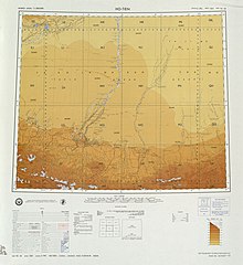 Map including Oytograk (labeled as Wo-t'o-la-k'o (Ao-i-t'o-ko-la-k'o)) and surrounding region in the International Map of the World (USATC, 1971)[lower-alpha 1]
 Map including Oytograk (labeled as Wo-t'o-la-k'o) (ATC, 1971)


Wikiwand in your browser!
Seamless Wikipedia browsing. On steroids.
Every time you click a link to Wikipedia, Wiktionary or Wikiquote in your browser's search results, it will show the modern Wikiwand interface.
Wikiwand extension is a five stars, simple, with minimum permission required to keep your browsing private, safe and transparent.