Loading AI tools
Amingaon (Assamese pronunciation: [ˈɑ:mɪnˌgɑ̃ʊ]) is a locality in North Guwahati.
Amingaon | |
|---|---|
Neighbourhood | |
| Coordinates: 26°11′18″N 91°40′42″E | |
| Country | India |
| State | Assam |
| District | Kamrup district |
| City | North Guwahati |
| Elevation | 31 m (102 ft) |
| Time zone | UTC+5:30 (IST) |
| PIN | 781 XXX |
| Vehicle registration | AS-01 |
| Lok Sabha constituency | Gauhati |
| Vidhan Sabha constituency | Jalukbari[1] |
It is at 26°11′0″N 91°40′0″E at an elevation of 31 m (102 ft) above mean sea level.[2]
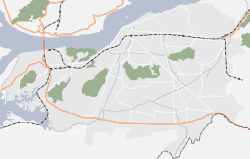
To its north and west is the Agyathuri hill, to its south is the Brahmaputra River, and to its east is IIT Guwahati. A large area of Amingaon is occupied by factories and warehouses, the largest aggregation being the Export Promotion Industrial Park (EPIP) located near the riverbank.
National Highway 27 passes through Amingaon. The nearest airport is Guwahati Airport. Amingaon houses the Agthori railway station, although it is not a major stoppage; and the historical Amin Gaon railway station.
It is connected to Guwahati via the Saraighat Bridge.
Wikiwand in your browser!
Seamless Wikipedia browsing. On steroids.
Every time you click a link to Wikipedia, Wiktionary or Wikiquote in your browser's search results, it will show the modern Wikiwand interface.
Wikiwand extension is a five stars, simple, with minimum permission required to keep your browsing private, safe and transparent.

