File:Ardennen03.png
維基百科,自由的 encyclopedia
預覽大小:716 × 600 像素。 其他解析度:287 × 240 像素 | 573 × 480 像素 | 917 × 768 像素 | 1,095 × 917 像素。
原始檔案 (1,095 × 917 像素,檔案大小:150 KB,MIME 類型:image/png)
| 描述Ardennen03.png |
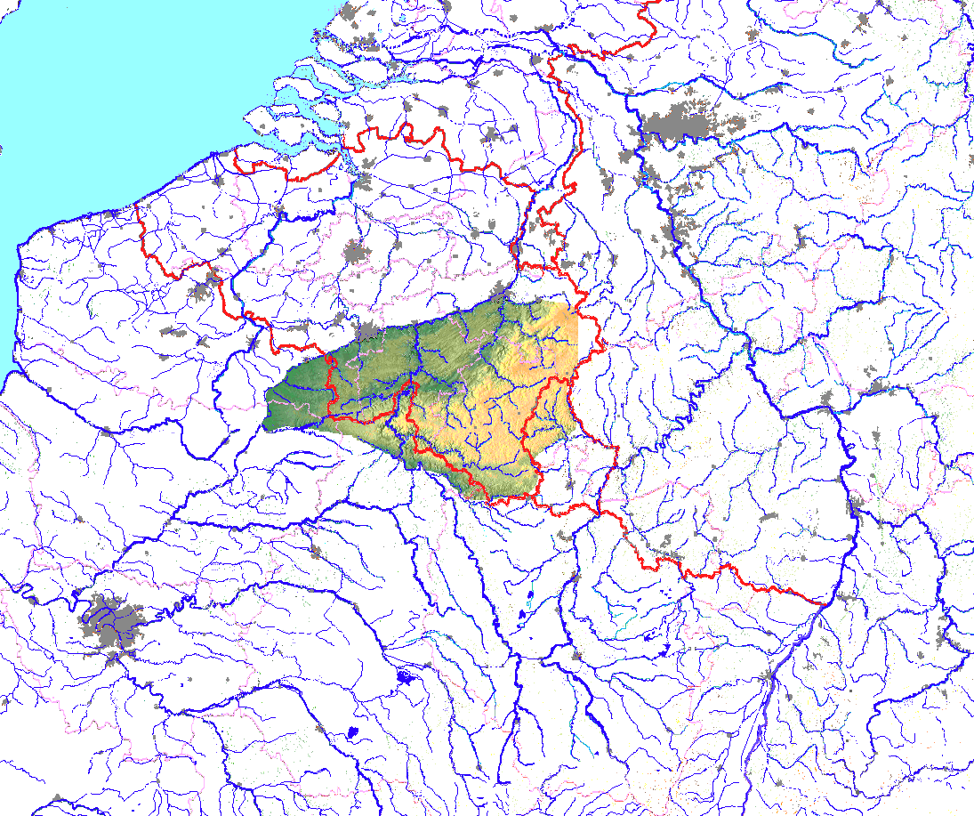
English: Location of Ardenne mountains, lecel coloured, in Belgium, France and Luxembourg
Deutsch: Lage der Ardennen, in Höhenschichtfarben, in Belgien, Frankreich und Luxemburg |
| 日期 | |
| 來源 | 自己的作品 and Google maps for free |
| 作者 | Ulamm |
| 授權許可 (重用此檔案) |
此檔案採用創用CC 姓名標示-相同方式分享 3.0 未在地化版本授權條款。
|
Die Flüsse sind per Hand nachgezogen. The rivers have been recountered by hand.
說明
添加單行說明來描述出檔案所代表的內容
ligging van de bergketen Ardennen, in België, Luxemburg en Frankrijk
在此檔案描寫的項目
描繪內容
16 11 2010
image/png
153,846 位元組
917 像素
1,095 像素
檔案歷史
點選日期/時間以檢視該時間的檔案版本。
| 日期/時間 | 縮圖 | 尺寸 | 使用者 | 備註 | |
|---|---|---|---|---|---|
| 目前 | 2010年11月16日 (二) 01:23 | | 1,095 × 917(150 KB) | Ulamm | {{Information |Description={{en|1=Location of Ardenne mountains, lecel coloured, in Belgium, France and Luxembourg}} {{de|1=Lage der Ardennen, in Höhenschichtfarben, in Belgien, Frankreich und Luxemburg}} |Source={{own}} and Google maps for free |Author= |
檔案用途
下列頁面有用到此檔案:
全域檔案使用狀況
以下其他 wiki 使用了這個檔案:
- bg.wikipedia.org 的使用狀況
- ca.wikipedia.org 的使用狀況
- da.wikipedia.org 的使用狀況
- de.wikipedia.org 的使用狀況
- el.wiktionary.org 的使用狀況
- en.wikipedia.org 的使用狀況
- eu.wikipedia.org 的使用狀況
- fi.wikipedia.org 的使用狀況
- fr.wikipedia.org 的使用狀況
- he.wikipedia.org 的使用狀況
- lv.wikipedia.org 的使用狀況
- mk.wikipedia.org 的使用狀況
- ms.wikipedia.org 的使用狀況
- nl.wikipedia.org 的使用狀況
- no.wikipedia.org 的使用狀況
- pl.wiktionary.org 的使用狀況
- stq.wikipedia.org 的使用狀況
- www.wikidata.org 的使用狀況