File:Java-Map.jpg
维基百科,自由的 encyclopedia
本预览的尺寸:800 × 557像素。 其他分辨率:320 × 223像素 | 640 × 445像素 | 1,024 × 713像素 | 1,280 × 891像素 | 2,560 × 1,782像素 | 3,000 × 2,088像素。
原始文件 (3,000 × 2,088像素,文件大小:1.12 MB,MIME类型:image/jpeg)
摘要
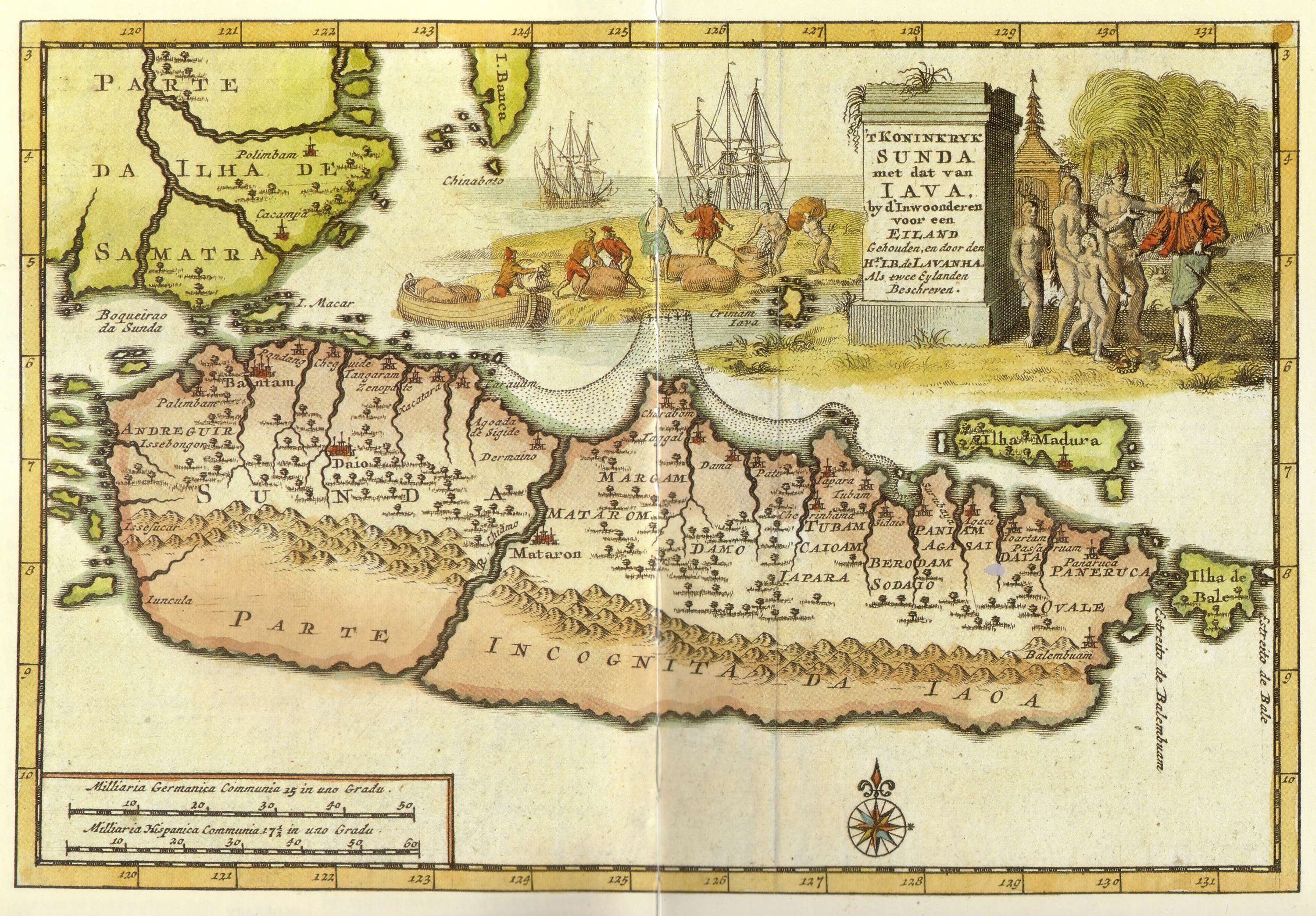
| 描述Java-Map.jpg |
Kingdom of Sunda and Java as two islands. The toponym includes: |
| 日期 |
18世纪早期 date QS:P,+1750-00-00T00:00:00Z/7,P4241,Q40719727 |
| 来源 | from "Java" - Periplus Adventure Guide. Periplus Editions 1997. ISBN 962-593-244-5 |
| 作者 |
Pieter van der Aa (1659-1733) Hr. L. B. de Lavanha |
| 其他版本 |
|

| 相机位置 | 6° 25′ 26.83″ 南, 109° 51′ 46.91″ 东 | 在以下服务上查看本图像和附近其他图像: OpenStreetMap |
|---|
许可协议
| Public domainPublic domainfalsefalse |
|
本作品在其来源国以及其他著作权期限是作者逝世后70年或以下的国家和地区属于公有领域。
| |
| 本文件已被确认为免除已知的著作权法限制(包括所有相关权利)。 | |
https://creativecommons.org/publicdomain/mark/1.0/PDMCreative Commons Public Domain Mark 1.0falsefalse
说明
添加一行文字以描述该文件所表现的内容
此文件中描述的项目
描绘内容
媒体类型 简体中文(已转写)
image/jpeg
数据大小 简体中文(已转写)
1,170,435 字节
2,088 像素
3,000 像素
视角坐标 简体中文(已转写)
6°25'26.832"S, 109°51'46.912"E
文件历史
点击某个日期/时间查看对应时刻的文件。
| 日期/时间 | 缩略图 | 大小 | 用户 | 备注 | |
|---|---|---|---|---|---|
| 当前 | 2008年1月20日 (日) 12:12 | | 3,000 × 2,088(1.12 MB) | Merbabu~commonswiki | {{Information |Description=Early 18th century Dutch map. |Source= |Date=early 18th century |Author= |Permission= |other_versions= }} |
文件用途
以下页面使用本文件:
全域文件用途
以下其他wiki使用此文件:
- ar.wikipedia.org上的用途
- ca.wikipedia.org上的用途
- en.wikipedia.org上的用途
- fr.wikipedia.org上的用途
- hr.wikipedia.org上的用途
- id.wikipedia.org上的用途
- it.wikipedia.org上的用途
- ja.wikipedia.org上的用途
- mk.wikipedia.org上的用途
- nl.wikipedia.org上的用途
- pl.wikipedia.org上的用途
- pnb.wikipedia.org上的用途
- ru.wikipedia.org上的用途
- ur.wikipedia.org上的用途
元数据
此文件中包含有扩展的信息。这些信息可能是由数码相机或扫描仪在创建或数字化过程中所添加。
如果此文件的源文件已经被修改,一些信息在修改后的文件中将不能完全反映出来。
| _error | 0 |
|---|