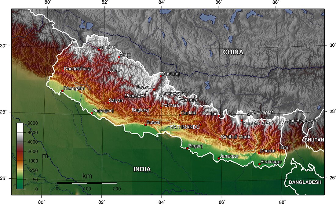
尼泊爾地質以喜馬拉雅山脈為主,這是一座最高、最年輕且非常活躍的山脈。 喜馬拉雅山脈是研究正在進行的大陸與大陸碰撞構造的典型地點。 喜馬拉雅弧從巴基斯坦北部印度河沿岸的南迦帕爾巴特峰(8,138米(26,699英尺))向東延伸約2,400 km(1,500 mi),到達雅魯藏布江-布拉馬普特拉河峽谷的南迦巴瓦峰(7,756米(25,446英尺))西藏東部[1]。 其中約800 km(500 mi)位於尼泊爾境內; 其餘地區包括不丹以及巴基斯坦、印度、和中國的部分地區。

自5500萬年以來,喜馬拉雅造山運動始於古新世/始新世時期印度次大陸與歐亞大陸的碰撞,已使印度地殼增厚至目前的70 km(43 mi)厚度[2]。 印度的西北端在與亞洲碰撞後似乎已經沿着縫合帶的全長相遇了約4000萬年[3]。
在印度-亞洲碰撞開始之前,印度地盾的北部邊界可能是一個變薄的大陸邊緣,其上沉積了元古宙碎屑沉積物和寒武紀±始新世特提斯陸架序列[1]。
尼泊爾喜馬拉雅山山地貌構造劃分
海姆(Heim)和甘塞爾(Gansser)將喜馬拉雅山脈的岩石分為四個構造地層區域,這些區域具有獨特的地層學和地形特徵[4]。 從南到北,可分為五個緯向地形構造帶,它們是:
參見
參考文獻
- Dewey, J.F.; Shackleton, Robert M.; Chengfa, Chang; Yiyin, Sun. The Tectonic Evolution of the Tibetan Plateau. Philosophical Transactions of the Royal Society of London. Series A, Mathematical and Physical Sciences. Philosophical Transactions of the Royal Society, A. 1988, 327 (1594): 379–413. Bibcode:1988RSPTA.327..379D. S2CID 122295871. doi:10.1098/rsta.1988.0135.
- Heim, Arnold; Gansser, Augusto. Central Himalaya Geological Observations of Swiss Expedition, 1936. 1939.
- Le Fort, P. Himalayas, the collided range: Present Knowledge of the continental arc. American Journal of Science. 1975, 275A: 1–44.
- Le Fort, P. Evolution of the Himalaya. Yin, A.; Harrison, T. M. (編). Tectonic Evolution of Asia. New York: Cambridge University Press. 1996: 95–109.
外部連結
Wikiwand in your browser!
Seamless Wikipedia browsing. On steroids.
Every time you click a link to Wikipedia, Wiktionary or Wikiquote in your browser's search results, it will show the modern Wikiwand interface.
Wikiwand extension is a five stars, simple, with minimum permission required to keep your browsing private, safe and transparent.
