File:Toowoomba_LGA_Qld_2008.png
維基百科,自由的 encyclopedia
此為最大尺寸。
Toowoomba_LGA_Qld_2008.png (400 × 535 像素,檔案大小:52 KB,MIME 類型:image/png)
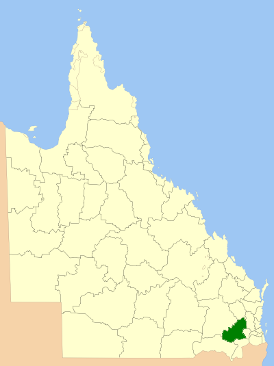
| 描述Toowoomba LGA Qld 2008.png | Location of the Local Government Area in Queensland |
| 日期 | |
| 來源 | 自己的作品 |
| 作者 | self |
| 授權許可 (重用此檔案) |
GNU Free Documentation License |

|
已授權您依據自由軟體基金會發行的無固定段落、封面文字和封底文字GNU自由文件授權條款1.2版或任意後續版本,對本檔進行複製、傳播和/或修改。該協議的副本列在GNU自由文件授權條款中。http://www.gnu.org/copyleft/fdl.htmlGFDLGNU Free Documentation Licensetruetrue |
| 此檔案採用共享創意 姓名標示-相同方式分享 3.0 未在地化版本授權條款。 | ||
| ||
| 已新增授權條款標題至此檔案,作為GFDL授權更新的一部份。http://creativecommons.org/licenses/by-sa/3.0/CC BY-SA 3.0Creative Commons Attribution-Share Alike 3.0truetrue |
說明
添加單行說明來描述出檔案所代表的內容
在此檔案描寫的項目
描繪內容
共享創意署名-相同方式共享3.0Unported Chinese (Hong Kong) (已轉換拼寫)
GNU自由文檔許可證1.2或更高版本 繁體中文 (已轉換拼寫)
3月 2008
檔案歷史
點選日期/時間以檢視該時間的檔案版本。
| 日期/時間 | 縮圖 | 尺寸 | 用戶 | 備註 | |
|---|---|---|---|---|---|
| 目前 | 2008年7月8日 (二) 00:35 | | 400 × 535(52 KB) | Roke~commonswiki | {{Information |Description=Location of the Local Government Area in Queensland |Source=self made |Date=March 2008 |Author=self |Permission=GNU Free Documentation License |other_versions= }} {{GF |
檔案用途
下列頁面有用到此檔案:
全域檔案使用狀況
以下其他 wiki 使用了這個檔案:
- bar.wikipedia.org 的使用狀況
- de.wikipedia.org 的使用狀況
- en.wikipedia.org 的使用狀況
- Local government areas of Queensland
- Toowoomba Region
- Birnam, Queensland (Toowoomba Region)
- Finnie, Queensland
- Redwood Park, Toowoomba
- Manapouri, Queensland
- Palmtree, Queensland
- Budgee, Queensland
- Cattle Creek, Queensland (Toowoomba Region)
- Cawdor, Queensland
- Coalbank, Queensland
- Djuan, Queensland
- St Helens, Queensland (Toowoomba Region)
- Jones Gully, Queensland
- Kincora, Queensland
- Kooralgin, Queensland
- Lavelle, Queensland
- Malling, Queensland
- Millwood, Queensland
- Muldu, Queensland
- Nevilton, Queensland
- North Maclagan, Queensland
- Plainby, Queensland
- Rocky Creek, Queensland
- Rossvale, Queensland
- Thornville, Queensland
- Tipton, Queensland
- Woodleigh, Queensland
- Elphinstone, Queensland (Toowoomba Region)
- Punchs Creek
- Cherry Creek, Queensland
- Mount Binga, Queensland
- Sandy Camp, Queensland
- Bulli Creek, Queensland
- Wattle Ridge, Queensland
- Woondul, Queensland
- Forest Ridge, Queensland
- The Pines, Queensland
- Scrubby Mountain, Queensland
- Mount Molar, Queensland
- Missen Flat, Queensland
- Mountain Camp, Queensland
- Template:Toowoomba-geo-stub
- Munro Tramway
- fr.wikipedia.org 的使用狀況
- hy.wikipedia.org 的使用狀況
檢視此檔案的更多全域使用狀況。