新城山
来自维基百科,自由的百科全书
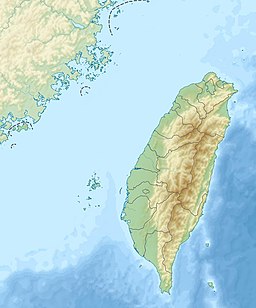
新城山(德路固語:Pngpung Uking,意為「Uking(太魯閣族的老祖先)居住的山頭」[5][6])是臺灣花蓮縣秀林鄉秀林村與富世村交界處的一座山峰,最高點海拔1441公尺,因緊鄰山腳的新城聚落而得名[7]。該山峰地處立霧溪與三棧北溪的分水嶺上,立有二等三角點1206號[8]。
新城山位於太魯閣國家公園轄區邊界上。
相關條目
參考資料
Wikiwand in your browser!
Seamless Wikipedia browsing. On steroids.
Every time you click a link to Wikipedia, Wiktionary or Wikiquote in your browser's search results, it will show the modern Wikiwand interface.
Wikiwand extension is a five stars, simple, with minimum permission required to keep your browsing private, safe and transparent.


