File:PIA09211.jpg
维基百科,自由的 encyclopedia
原始文件 (1,544 × 1,292像素,文件大小:330 KB,MIME类型:image/jpeg)
摘要
| 描述PIA09211.jpg |
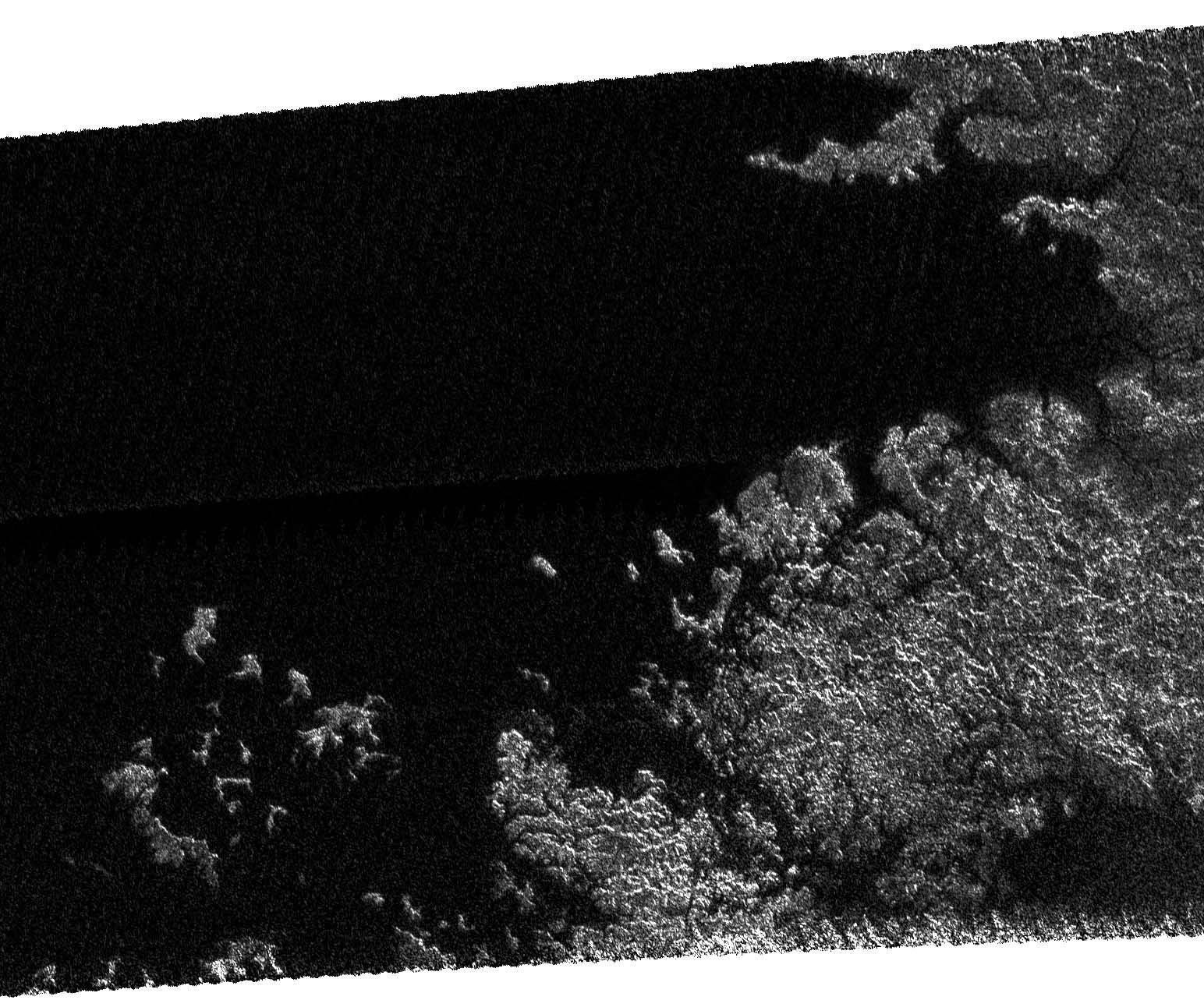
On May 12, 2007, Cassini completed its 31st flyby of Saturn's moon Titan, which the team calls T30. The radar instrument obtained this image showing the coastline and numerous island groups of a portion of a large sea, consistent with the larger sea seen by the Cassini imaging instrument (See Seeing Farther North). Like other bodies of liquid seen on Titan, this feature reveals channels, islands, bays, and other features typical of terrestrial coastlines, and the liquid, most likely a combination of methane and ethane, appears very dark to the radar instrument. What is striking about this portion of the sea compared to other liquid bodies on Titan is the relative absence of brighter regions within it, suggesting that the depth of the liquid here exceeds tens of meters (tens of yards). Of particular note is the presence of isolated islands, which follow the same direction as the peninsula to their lower right, suggesting that they may be part of a mountain ridgeline that has been flooded. This is analogous to, for example, Catalina Island off the coast of Southern California. The image as shown is about 160 kilometers (100 miles) by 270 kilometers (170 miles) at 300-meter (980-foot) resolution. The image is centered near 70 degrees north latitude and 310 west longitude. |
| 日期 | |
| 来源 | http://saturn.jpl.nasa.gov/multimedia/images/image-details.cfm?imageID=2614 |
| 作者 | NASA/JPL |
许可协议
| Public domainPublic domainfalsefalse |
| 本文件完全由NASA创作,在美国属于公有领域。根据NASA的版权方针,NASA的材料除非另有声明否则不受版权保护。(参见Template:PD-USGov/zh、NASA版权方针页面或JPL图片使用方针。) | ||
 |
警告:
|
说明
此文件中描述的项目
描绘内容
23 5 2007
文件历史
点击某个日期/时间查看对应时刻的文件。
| 日期/时间 | 缩略图 | 大小 | 用户 | 备注 | |
|---|---|---|---|---|---|
| 当前 | 2007年5月24日 (四) 17:12 | | 1,544 × 1,292(330 KB) | PeterfromTitan~commonswiki | {{Information |Description=On May 12, 2007, Cassini completed its 31st flyby of Saturn's moon Titan, which the team calls T30. The radar instrument obtained this image showing the coastline and numerous island groups of a portion of a large sea, consisten |
文件用途
以下页面使用本文件:
全域文件用途
以下其他wiki使用此文件:
- ar.wikipedia.org上的用途
- ca.wikipedia.org上的用途
- en.wikipedia.org上的用途
- hi.wikipedia.org上的用途
- hy.wikipedia.org上的用途
- ja.wikipedia.org上的用途
- ka.wikipedia.org上的用途
- nl.wikipedia.org上的用途
- pt.wikipedia.org上的用途
- ru.wikipedia.org上的用途
- ta.wikipedia.org上的用途
- xmf.wikipedia.org上的用途
元数据
此文件中包含有扩展的信息。这些信息可能是由数码相机或扫描仪在创建或数字化过程中所添加。
如果此文件的源文件已经被修改,一些信息在修改后的文件中将不能完全反映出来。
| _error | 0 |
|---|