
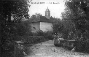
Charancieu
comun fransexo / From Wikipedia, the free encyclopedia
Charancieu el xe on comun de 774 abitanti del departemento de Isère che el fa parte del rejon Alvergna-Rodano-Alpe in Fransa.
Info velòsi Pozision, Popołasion ...
| Charancieu (fr) | |||||||||
|---|---|---|---|---|---|---|---|---|---|
| |||||||||
| Pozision | |||||||||
| Stato | Fransa | ||||||||
| Teritòrio | Fransa metropułitana | ||||||||
| Rejon | Alvergna-Rodano-Alpe | ||||||||
| Departemento | Isère | ||||||||
| Arrondissement | arrondissement de la Tour-du-Pin | ||||||||
| Canton | canton de Saint-Geoire-en-Valdaine | ||||||||
| Popołasion | |||||||||
| Totałe | 758 (1° de zenaro del 2021) | ||||||||
| Densità | 137,07 hab./km² | ||||||||
| Zènaro |
| ||||||||
| Zeografia | |||||||||
| Rejon statìstega | unité urbaine des Abrets en Dauphiné (fr) | ||||||||
| Àrea | 5,53 km²[1] | ||||||||
| Rente a | |||||||||
| Còdazi de identifegasion | |||||||||
| Còdaze postałe | 38490 | ||||||||
| Sito web | mairie-charancieu.fr | ||||||||
|
| |||||||||

Sara