దస్త్రం:Bihar_in_India.png
From Wikipedia, the free encyclopedia
Bihar_in_India.png (350 × 426 పిక్సెళ్ళు, ఫైలు పరిమాణం: 76 KB, MIME రకం: image/png)
This is a file from the Wikimedia Commons. Information from its description page there is shown below. Commons is a freely licensed media file repository. You can help. |
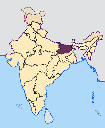
Map made by me, Nichalp
Note: The Indian state of w:Jammu and Kashmir is claimed by w:India, w:Pakistan and the w:People's Republic of China. This map depicts the boundaries of the state as it was in 1947. Areas administered by India is coloured as per the rest of the states, and the area administered by Pakistan and China are coloured in a neutral colour. See the map of Jammu and Kashmir.
The Indian state of w:Arunachal Pradesh is claimed by China as a part of w:South Tibet. The claimed region is depicted in a pale shade of pink. See the map of Arunachal Pradesh.
The Indian territorial waters extend to a distance of twelve nautical miles.

|
ఈ కృతి యొక్క కర్తనైన నేను, ఇక నుండీ ఈ కృతిని కాపీ చేసుకోవడానికి, పంచి పెట్టడానికి మరియు/లేదా మార్పులు-చేర్పులు చేసుకోవడానికి GFDL, లైసెన్సు వెర్షను 1.2 లేదా దాని తరువాత స్వేచ్చా సాఫ్టువేరు ఫౌండేషను విడుదలచేసే ఏ GFDL లైసెన్సు ద్వారా నయినా అనుమతి ఇస్తున్నాను; ఈ కృతిలో మార్చకూడని బాగాలు లేవు, Front-Cover పాఠం లేదు, Back-Cover పాఠం లేదు. ఈ లైసెన్సు యొక్క పత్రం నకలును "జిఎన్యూ ఉచిత డాక్యుమెంటేషను లైసెన్సు" అని పిలుస్తున్న విభాగంలో ఉంది.http://www.gnu.org/copyleft/fdl.htmlGFDLGNU Free Documentation Licensetruetrue |
| ఈ దస్త్రం క్రియేటివ్ కామన్స్ Attribution-Share Alike 3.0 Unported లైసెన్సు క్రింద లభ్యం. | ||
| ||
| GFDL లైసెన్సు తాజాకరణలో భాగంగా ఈ దస్త్రానికి ఈ లైసెన్సింగు ట్యాగుని చేర్చారు.http://creativecommons.org/licenses/by-sa/3.0/CC BY-SA 3.0Creative Commons Attribution-Share Alike 3.0truetrue |
Captions
Items portrayed in this file
చిత్రణ
copyright status ఇంగ్లీష్
copyrighted ఇంగ్లీష్
media type ఇంగ్లీష్
image/png
checksum ఇంగ్లీష్
e294d529430ef10d5a76e3a524b065ffbde09b52
data size ఇంగ్లీష్
78,185 బైట్
426 చిణువు
350 చిణువు
ఫైలు చరితం
తేదీ/సమయం ను నొక్కి ఆ సమయాన ఫైలు ఎలా ఉండేదో చూడవచ్చు.
| తేదీ/సమయం | నఖచిత్రం | కొలతలు | వాడుకరి | వ్యాఖ్య | |
|---|---|---|---|---|---|
| ప్రస్తుత | 07:27, 23 ఏప్రిల్ 2005 | | 350 × 426 (76 KB) | Nichalp | NPOV map |
| 07:21, 23 ఏప్రిల్ 2005 |  | 200 × 231 (22 KB) | Kerpal | Reverted to earlier revision | |
| 06:18, 23 ఏప్రిల్ 2005 |  | 500 × 608 (121 KB) | Nichalp | Reverted to earlier revision | |
| 04:59, 23 ఏప్రిల్ 2005 |  | 200 × 231 (22 KB) | Kerpal | Reverted to earlier revision | |
| 04:51, 23 ఏప్రిల్ 2005 |  | 500 × 608 (121 KB) | Nichalp | Reverted to earlier revision | |
| 21:04, 22 ఏప్రిల్ 2005 |  | 200 × 231 (22 KB) | Kerpal | Reverted to earlier revision | |
| 13:43, 22 ఏప్రిల్ 2005 |  | 500 × 608 (121 KB) | Nichalp | Reverted to earlier revision | |
| 09:55, 22 ఏప్రిల్ 2005 |  | 200 × 231 (22 KB) | Kerpal | originally by en:User:Morwen | |
| 17:49, 21 ఏప్రిల్ 2005 |  | 500 × 608 (121 KB) | Nichalp | Map made by me, ~~~ Note: The Indian state of w:Jammu and Kashmir is claimed by w:India, w:Pakistan and the w:People's Republic of China. This map depicts the boundaries of the state as it was in 1947. Areas administered by India is colo |
లింకులు
కింది పేజీలలో ఈ ఫైలుకు లింకులు ఉన్నాయి:
సార్వత్రిక ఫైలు వాడుక
ఈ దస్త్రాన్ని ఈ క్రింది ఇతర వికీలు ఉపయోగిస్తున్నాయి:
- bn.wikipedia.org లో వాడుక
- bxr.wikipedia.org లో వాడుక
- en.wikipedia.org లో వాడుక
- es.wikipedia.org లో వాడుక
- hi.wikipedia.org లో వాడుక
- ka.wikipedia.org లో వాడుక
- kn.wikipedia.org లో వాడుక
- mr.wikipedia.org లో వాడుక
- ta.wikinews.org లో వాడుక
- xmf.wikipedia.org లో వాడుక
మెటాడేటా
ఈ ఫైలులో అదనపు సమాచారం ఉంది, బహుశా దీన్ని సృష్టించడానికి లేదా సాంఖ్యీకరించడానికి వాడిన డిజిటల్ కేమెరా లేదా స్కానర్ ఆ సమాచారాన్ని చేర్చివుండవచ్చు. ఈ ఫైలును అసలు స్థితి నుండి మారిస్తే, ఆ మారిన ఫైలులో కొన్ని వివరాలు పూర్తిగా ప్రతిఫలించకపోవచ్చు.
| ఉపయోగించిన సాఫ్ట్వేర్ |
|
|---|