Ugarit
ancient port city in northern Syria From Wikipedia, the free encyclopedia
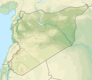
Ugarit (/juːˈɡɑːrɪt, uː-/;[1] Ugaritic: 𐎜𐎂𐎗𐎚, ʼUgart; Arabic: أُوغَارِيت Ūġārīt or أُوجَارِيت Ūǧārīt) was an ancient port city in northern Syria. It is in the outskirts of modern Latakia. It was discovered by accident in 1928 together with the Ugaritic texts.[2] Its ruins are often called Ras Shamra[3] due to the headland on which they are found.
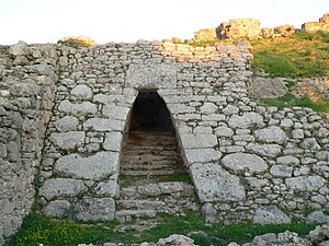
 Entrance to the Royal Palace of Ugarit | |
| Alternate name | Ras Shamra (Arabic: رأس شمرة) |
|---|---|
| Location | Latakia Governorate, Syria |
| Region | Fertile Crescent |
| Coordinates | 35.602°N 35.782°E |
| Type | settlement |
| History | |
| Founded | c. 6000 BCE |
| Abandoned | c. 1190 BCE |
| Periods | Neolithic–Late Bronze Age |
| Cultures | Canaanite |
| Events | Bronze Age collapse |
| Site notes | |
| Excavation dates | 1928–present |
| Archaeologists | Claude F. A. Schaeffer |
| Condition | ruins |
| Ownership | Public |
| Public access | Yes |
Ugarit had close connections to the Hittite Empire. It also sent tribute to Egypt at times and maintained trade and diplomatic connections with Cyprus (then called Alashiya).[4][5] This is documented in the archives recovered from the site. It is confirmed by Mycenaean and Cypriot pottery found there. The polity was at its height from c. 1450 BCE until its destruction in c. 1200 BCE. This destruction was possibly caused by the mysterious Sea Peoples or internal struggle. The kingdom would be one of the many that fell apart during the Bronze Age Collapse.
References
Wikiwand - on
Seamless Wikipedia browsing. On steroids.


