Teesta River
river that flows from the eastern Himalayas to the Bay of Bengal From Wikipedia, the free encyclopedia
The Teesta River (or Tista) is a river in the Indian state of Sikkim. It is 309 kilometres (192 miles) long.
| Teesta River | |
|---|---|
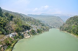
 Teesta in Siliguri, West Bengal | |
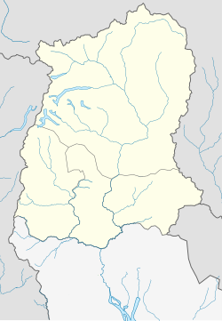
 Path of the Teesta | |
| Location | |
| Country | India, Bangladesh |
| State | Sikkim, West Bengal, Rangpur Division |
| District | Kurigram District, Nilphamari District, Gangtok District, Pakyong District, Mangan District, Kalimpong district, Darjeeling district, Cooch Behar district and Jalpaiguri district |
| City | Singtam, Rangpo, Kalimpong, Jalpaiguri, Mekhliganj |
| Physical characteristics | |
| Source | Pauhunri, Zemu Glacier, Gurudongmar Lake, Tso Lhamo Lake |
| - location | Sikkim, India |
| - elevation | 7,128 m (23,386 ft)[1] |
| Mouth | Brahmaputra river |
| - location | Phulchhari Upazila, Gaibandha, Bangladesh |
| Length | 414 km (257 mi)[1] |
| Basin size | 12,540 km2 (4,840 sq mi)[2] |
| Basin features | |
| Tributaries | |
| - left | Rangpo River, Lachung River, Ranikhola, Relli River, Talung River, Dik Chhu, Lang Lang Chu |
| - right | Rangeet River, Ringyong Chhu, Ranghap Chhu |
Course
The Teesta river starts at Pahunri glacier, and flows south through rapids in the Sikkim Himalaya. The river goes by the town of Rangpo. It changes course southwards flowing into West Bengal, before joining the Brahmaputra River.
References
Wikiwand - on
Seamless Wikipedia browsing. On steroids.


