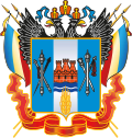
Rostov Oblast
federal subject of Russia From Wikipedia, the free encyclopedia
Rostov Oblast (Russian: Росто́вская о́бласть, tr. Rostovskaya oblast, IPA: [rɐˈstofskəjə ˈobləsʲtʲ]) is a federal subject of Russia (an oblast). The oblast has an area of 100,800 square kilometers (38,900 sq mi). 4,277,976 people lived here (2010 Census).
| Rostov Oblast Ростовская область (Russian) | |||
|---|---|---|---|
| — Oblast — | |||
| |||
Anthem: Anthem of Rostov Oblast (The Orthodox Quiet Don)[1] | |||
Coordinates: 47°52′N 41°11′E | |||
| Political status | |||
| Country | Russia | ||
| Federal district | Southern[2] | ||
| Economic region | North Caucasus[3] | ||
| Established | September 13, 1937[4] | ||
| Administrative center | Rostov-on-Don | ||
| Government (as of August 2014) | |||
| • Governor[5] | Vasily Golubev[6] | ||
| • Legislature | Legislative Assembly | ||
| Statistics | |||
| Area (as of the 2002 Census)[7] | |||
| • Total | 100,800 km2 (38,900 sq mi) | ||
| Area rank | 32nd | ||
| Population (2010 Census) | |||
| • Total | 4,277,976 | ||
| • Rank | 6th | ||
| • Density[8] | 42.44/km2 (109.9/sq mi) | ||
| • Urban | 67.2% | ||
| • Rural | 32.8% | ||
| Population (January 2013 est.) | |||
| • Total | 4,254,600[9] | ||
| Time zone(s) | MSK (UTC+04:00) | ||
| ISO 3166-2 | RU-ROS | ||
| License plates | 61, 161, 761 | ||
| Official languages | Russian[10] | ||
| Official website | |||
References
Wikiwand - on
Seamless Wikipedia browsing. On steroids.


