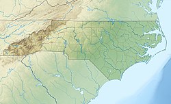
Charlotte Douglas International Airport
international airport in Charlotte, North Carolina, United States From Wikipedia, the free encyclopedia
Remove ads
Charlotte Douglas International Airport (IATA: CLT, ICAO: KCLT, FAA LID: CLT) is a joint civil-military public international airport. It is located in Charlotte, North Carolina. It was the 6th busiest airport in the world, based on traffic movements in 2010.[4] It was also the 23rd busiest airport in the world by passenger traffic in 2013.[5] The airport was opened in 1936 as the Charlotte Municipal Airport. It was renamed the Douglas Municipal Airport after former mayor of Charlotte Ben Elbert Douglas, Sr. in 1954. It was the largest hub for US Airways.[6] In 2015, US Airways was combined with American Airlines. Now, Charlotte is the 2nd largest hub for American.
Remove ads
Remove ads
Gallery
- A Lufthansa plane taking off from Charlotte.
- A Southwest Boeing 737-700 landing at Charlotte.
- Map of Charlotte Airport.
References
Other websites
Wikiwand - on
Seamless Wikipedia browsing. On steroids.
Remove ads


