county in Connecticut, United States From Wikipedia, the free encyclopedia
Litchfield County is located in the northwestern corner of the U.S. State of Connecticut. As of the 2020 census, the population was 185,186.[1] The county has a total area of 2,446 km² (945 mi²). 2,383 km² (920 mi²) of it is land and 64 km² (25 mi²) of it is water. The total area is 2.61% water.
Litchfield County | |
|---|---|
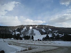
 Mohawk Mountain Ski Area in Cornwall. | |
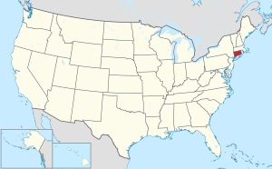
 Location within the U.S. state of Connecticut | |
 Connecticut's location within the U.S. | |
| Coordinates: 41.79°N 73.24°W | |
| Country | |
| State | |
| Founded | 1751 |
| Named for | Lichfield, England |
| Seat | none (since 1960) Litchfield (before 1960) |
| Largest city | Torrington |
| Area | |
| • Total | 945 sq mi (2,450 km2) |
| • Land | 921 sq mi (2,390 km2) |
| • Water | 24 sq mi (60 km2) 2.5% |
| Population | |
| • Total | 185,186 |
| • Density | 196.0/sq mi (75.7/km2) |
| Time zone | UTC−5 (Eastern) |
| • Summer (DST) | UTC−4 (EDT) |
Seamless Wikipedia browsing. On steroids.
Every time you click a link to Wikipedia, Wiktionary or Wikiquote in your browser's search results, it will show the modern Wikiwand interface.
Wikiwand extension is a five stars, simple, with minimum permission required to keep your browsing private, safe and transparent.