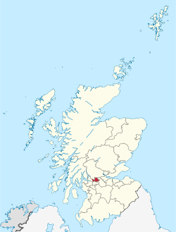
East Dunbartonshire
From Wikipedia, the free encyclopedia
Remove ads
East Dunbartonshire is ane o the 32 cooncil areas o Scotland. It borders ontil the north-wast o the Ceitie o Glesga. It inhauds monie o the suburbs o Glesga as weil as monie o the ceitie's commuter touns an veilages (Bearsden, Milngavie, Bishopbriggs, Kirkintilloch an Lenzie bein the mukkilest).[1] East Dunbartonshire skares a mairch wi Wast Dunbartonshire, Stirlin, an North Lanrikshire anaw. The cooncil area kivers pairt o the umwhyl coontie o Stirlinshire as weil as pairts o the umwhyl coonties o Dunbartonshire an Lanrikshire.
Remove ads
Touns an veilages
- Auchenhowie
- Auchinairn
- Auchinreoch
- Baldernock
- Balmore
- Bardowie
- Bairnellan
- Bearsden
- Birdstoun
- Bishopbriggs
- Cadder
- Clachan o Campsie
- Craigtoun
- Dougalstoun
- Haughheid
- Kirkintilloch
- Langbank
- Lennoxtoun
- Lenzie
- Milngavie
- Milton o Campsie
- Torrance
- Twechar
- Wattirside
Steids o interest
- Campsie Fells
- Wast Hieland Wey
- Forth an Clyde Canal
- Antonine Waw
- Mugdock Kintra Pairk
- Tom Johnston Houss
- Auld Kirk Museum
- Huntershill Veilage
- The Gadloch
Referenses
Wikiwand - on
Seamless Wikipedia browsing. On steroids.
Remove ads

