Sierra Nevada (U.S.)
From Wikipedia, the free encyclopedia
The Sierra Nevada (/siˈɛrə nᵻˈvɑːdə/ or /nᵻˈvædə/, Spaingie: [ˈsjera neˈβaða], snawy range[6]) is a moontain range in the wastren Unitit States, atween the Central Valley o Californie an the Basin an Range Province.
| Sierra Nevada | |
|---|---|
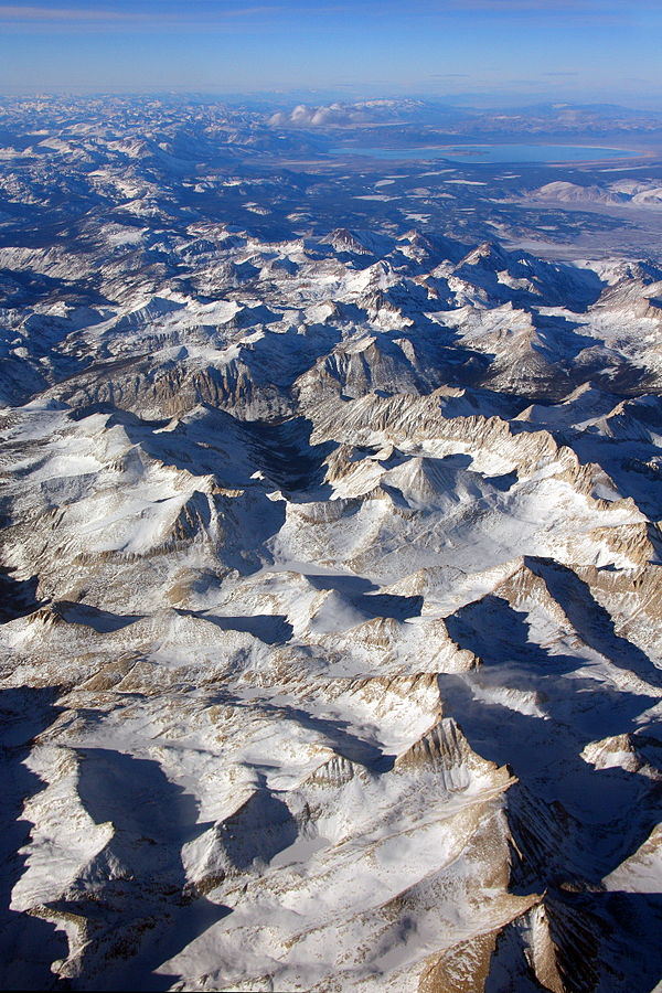
 The Sierra's Mills Creek cirque (center) is on the wast side of the Sierra Crest, sooth o Mono Loch (tap, blue). | |
| Heichest pynt | |
| Peak | Moont Whitney |
| Elevation | 14,505 ft (4,421 m) [1] |
| Coordinates | 36°34′43″N 118°17′31″W |
| Dimensions | |
| Lenth | 400 mi (640 km) north-sooth frae Fredonyer Pass tae Tehachapi Pass [2] |
| Weenth | 65 mi (105 km) [3] |
| Aurie | 24,370 sq mi (63,100 km2) [4] |
| Namin | |
| Etymology | 1777: Spainyie for "snawy moontain range" |
| Nickname | the Sierra, the High Sierra, the Sierras, Range of Light (1894, John Muir)[5] |
| Geografie | |
| Kintra | Unitit States |
| States | Californie and Nevada |
| Range coordinates | 37°43′51″N 119°34′22″W |
| Geology | |
| Age o rock | Mesozoic |
| Teep o rock | batholith and igneous |
References
Wikiwand in your browser!
Seamless Wikipedia browsing. On steroids.
Every time you click a link to Wikipedia, Wiktionary or Wikiquote in your browser's search results, it will show the modern Wikiwand interface.
Wikiwand extension is a five stars, simple, with minimum permission required to keep your browsing private, safe and transparent.

