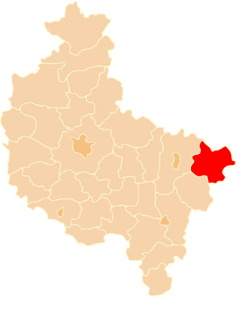
Koło (powiat kolski) is een district (powiat) in de Poolse woiwodschap Groot-Polen. De oppervlakte bedraagt 1011,03 km², het inwonertal 88.848 (2014).
| District in Polen | |||
|---|---|---|---|
 | |||
| Situering | |||
| Land | Polen | ||
| Woiwodschap | Groot-Polen | ||
| Coördinaten | 52°12'NB, 18°38'OL | ||
| Gegevens | |||
| Oppervlakte | 1011,03 km² | ||
| Inwoners (31-12-2014) |
88.848 (87,9 inw./km²) | ||
| Bron: | Pools Bureau voor Statistiek | ||
| Website | starostwokolskie.pl | ||
| |||
Wikiwand in your browser!
Seamless Wikipedia browsing. On steroids.
Every time you click a link to Wikipedia, Wiktionary or Wikiquote in your browser's search results, it will show the modern Wikiwand interface.
Wikiwand extension is a five stars, simple, with minimum permission required to keep your browsing private, safe and transparent.


