चित्र:Mallorca.jpg
From Wikipedia, the free encyclopedia
या झलकेचा आकार: ७८५ × ५९९ पिक्सेल पिक्सेल. इतर resolutions: ३१४ × २४० पिक्सेल | ६२९ × ४८० पिक्सेल | १,००६ × ७६८ पिक्सेल | १,१३८ × ८६९ पिक्सेल.
मूळ संचिका (१,१३८ × ८६९ पिक्सेल, संचिकेचा आकार: १६४ कि.बा., MIME प्रकार: image/jpeg)
ही संचिका Wikimedia Commons येथील असून ती इतर प्रकल्पात वापरलेली असू शकते. तिचे तेथील संचिका वर्णन पान खाली दाखवले आहे.
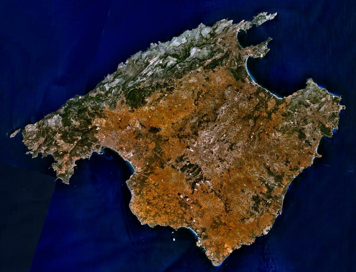
| वर्णनMallorca.jpg | Sattelite image of Majorca |
| स्रोत | NASA World Wind - Used Filter: "NTL Landsat7 (Visible Color)" |
| लेखक | NASA |
| परवानगी (या संचिकेचा पुनर्वापर करीत आहे) |
"The Landsat Global Mosiac, Blue Marble, and the USGS raster maps and images are all Public Domain." (See http://www.worldwindcentral.com/wiki/Unofficial_FAQ#Are_images_on_World_Wind_copyrighted.3F |
| Public domainPublic domainfalsefalse |
| This image is in the public domain because it is a screenshot from NASA’s globe software World Wind using a public domain layer, such as Blue Marble, MODIS, Landsat, SRTM, USGS or GLOBE.
العربيَّة | English | فارسی | français | עברית | македонски | മലയാളം | Nederlands | русский | 中文(中国大陆) | +/− |
 |
Captions
Add a one-line explanation of what this file represents
Satellite image of Majorca
Imagen de satélite de Mallorca
Photographie satellite de l'île de Majorque
Items portrayed in this file
depicts इंग्रजी
satellite imagery इंग्रजी
image/jpeg
संचिकेचा इतिहास
संचिकेची त्यावेळची आवृत्ती बघण्यासाठी त्या दिनांक/वेळेवर टिचकी द्या.
| दिनांक/वेळ | छोटे चित्र | आकार | सदस्य | प्रतिक्रीया | |
|---|---|---|---|---|---|
| सद्य | २२:४९, ५ जून २०२३ | | १,१३८ × ८६९ (१६४ कि.बा.) | PalauanLibertarian | Cropped 11 % horizontally, 8 % vertically using CropTool with precise mode. |
| ०१:०१, ३१ डिसेंबर २०१२ |  | १,२८० × ९४४ (१७४ कि.बा.) | Rotatebot | Bot: Image rotated by 180° | |
| १४:४६, ३० डिसेंबर २०१२ |  | १,२८० × ९४४ (१७४ कि.बा.) | Rotatebot | Bot: Image rotated by 180° | |
| १३:५९, १५ मे २००५ |  | १,२८० × ९५८ (१७५ कि.बा.) | Leipnizkeks | Sattelite image of Majorca - Source: NASA World Wind - Used Filter: "NTL Landsat7 (Visible Color)" - License: "The Landsat Global Mosiac, Blue Marble, and the USGS raster maps and images are all Public Domain." (See http://www.worldwindcentral.com/wiki/Un |
दुवे
खालील पाने या संचिकेला जोडली आहेत:
जागतिक संचिका उपयोग
संचिकाचे इतर विकिपीडियावरील वापरः
- af.wikipedia.org वरील उपयोग
- an.wikipedia.org वरील उपयोग
- ar.wikipedia.org वरील उपयोग
- arz.wikipedia.org वरील उपयोग
- ast.wikipedia.org वरील उपयोग
- az.wikipedia.org वरील उपयोग
- be-tarask.wikipedia.org वरील उपयोग
- be.wikipedia.org वरील उपयोग
- bg.wikipedia.org वरील उपयोग
- br.wikipedia.org वरील उपयोग
- ca.wikipedia.org वरील उपयोग
- Illes Balears
- Mallorca
- Llista d'illes de la mar Mediterrània
- Portal:Illes Balears
- Portal:Illes Balears/Mallorca
- Plantilla:Distribució en les Illes Balears
- Usuari:Bilif
- Geografia dels Països Catalans
- Geografia de les Illes Balears
- Usuari:Aïda Lacomba Moreno
- Usuari:Maria quetglas
- Viquiprojecte:PESCAR/2018
- Viquiprojecte:PESCAR/seguiment 2018
- ca.wikiquote.org वरील उपयोग
- ceb.wikipedia.org वरील उपयोग
- cs.wikipedia.org वरील उपयोग
- cy.wikipedia.org वरील उपयोग
- da.wikipedia.org वरील उपयोग
- de.wikipedia.org वरील उपयोग
- de.wikivoyage.org वरील उपयोग
- de.wiktionary.org वरील उपयोग
- el.wikipedia.org वरील उपयोग
- en.wikipedia.org वरील उपयोग
या संचिकेचे अधिक वैश्विक उपयोग पहा
"https://mr.wikipedia.org/wiki/चित्र:Mallorca.jpg" पासून हुडकले