ಚಿತ್ರ:Pacific_Ocean.png
From Wikipedia, the free encyclopedia
Pacific_Ocean.png (೩೩೦ × ೩೩೦ ಚಿತ್ರಬಿಂದು, ಫೈಲಿನ ಗಾತ್ರ: ೨೮ KB, MIME ಪ್ರಕಾರ: image/png)
ಈ ಫೈಲು ವಿಕಿಮೀಡಿಯ ಕಾಮನ್ಸ್ನಲ್ಲಿ ಇರುವುದು. ಅಲ್ಲಿನ ವಿವರಣೆ ಪುಟವನ್ನೇ ಕೆಳಗೆ ತೋರಿಸಲಾಗಿದೆ. ಕಾಮನ್ಸ್ ಕೃತಿಸ್ವಾಮ್ಯತೆಯಿಂದ ಮುಕ್ತ ಫೈಲುಗಳ ಒಂದು ಆಗರ. ಅಲ್ಲಿ ನೀವೂ ಸಹಕರಿಸಬಹುದು. |
ಸಾರಾಂಶ
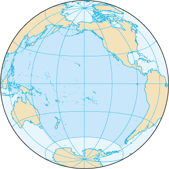
| ವಿವರPacific Ocean.png |
English: Pacific Ocean map, tagged in English |
| ದಿನಾಂಕ | |
| ಆಕರ | CIA World Factbook |
| ಕರ್ತೃ | CIA World Factbook |
| ಇತರೆ ಆವೃತ್ತಿಗಳು |
Derivative works of this file: |
.png)

|
This locator map image could be re-created using vector graphics as an SVG file. This has several advantages; see Commons:Media for cleanup for more information. If an SVG form of this image is available, please upload it and afterwards replace this template with
{{vector version available|new image name}}.
It is recommended to name the SVG file “Pacific Ocean.svg”—then the template Vector version available (or Vva) does not need the new image name parameter. |
ಪರವಾನಗಿ
| Public domainPublic domainfalsefalse |
This image is in the public domain because it contains materials that originally came from the United States Central Intelligence Agency's World Factbook.
Bahasa Indonesia ∙ čeština ∙ Deutsch ∙ eesti ∙ English ∙ español ∙ Esperanto ∙ français ∙ galego ∙ hrvatski ∙ italiano ∙ Nederlands ∙ norsk nynorsk ∙ polski ∙ português ∙ sicilianu ∙ slovenščina ∙ suomi ∙ Türkçe ∙ Zazaki ∙ беларуская (тарашкевіца) ∙ македонски ∙ русский ∙ српски / srpski ∙ українська ∙ ქართული ∙ বাংলা ∙ தமிழ் ∙ മലയാളം ∙ 한국어 ∙ 日本語 ∙ 中文 ∙ 中文(简体) ∙ 中文(繁體) ∙ العربية ∙ +/− |
 |
Original upload log
This file was originaly uploaded to en.wikipedia as File:Pacificocean.PNG, if you have access to the deleted history, you could to complete this field.
Captions
Items portrayed in this file
depicts ಇಂಗ್ಲಿಷ್
೧ ನವೆಂಬರ್ 2006
media type ಇಂಗ್ಲಿಷ್
image/png
ಕಡತದ ಇತಿಹಾಸ
ದಿನ/ಕಾಲ ಒತ್ತಿದರೆ ಆ ಸಮಯದಲ್ಲಿ ಈ ಕಡತದ ವಸ್ತುಸ್ಥಿತಿ ತೋರುತ್ತದೆ.
| ದಿನ/ಕಾಲ | ಕಿರುನೋಟ | ಆಯಾಮಗಳು | ಬಳಕೆದಾರ | ಟಿಪ್ಪಣಿ | |
|---|---|---|---|---|---|
| ಪ್ರಸಕ್ತ | ೦೧:೦೩, ೨೮ ಆಗಸ್ಟ್ ೨೦೧೯ | | ೩೩೦ × ೩೩೦ (೨೮ KB) | Kaldari | removing black triagle |
| ೦೦:೪೬, ೨೮ ಆಗಸ್ಟ್ ೨೦೧೯ |  | ೩೩೦ × ೩೩೦ (೧೪ KB) | Kaldari | Reverting sloppy background removal leaving jagged edges, and also to be consistent with other ocean maps | |
| ೧೫:೪೧, ೩೦ ಜುಲೈ ೨೦೧೯ |  | ೩೩೦ × ೩೩೦ (೧೩ KB) | Aplaice | Reduce file size back to previous levels (from 2009) while keeping transparent background (as in 2017). | |
| ೨೧:೧೭, ೨೧ ಜೂನ್ ೨೦೧೭ |  | ೩೩೦ × ೩೩೦ (೯೮ KB) | Wiki test 0001 | Underground the change Surrounding background. | |
| ೦೧:೪೬, ೨೩ ಆಗಸ್ಟ್ ೨೦೦೯ |  | ೩೩೦ × ೩೩೦ (೧೪ KB) | Serg!o | language neutral map | |
| ೦೪:೨೨, ೫ ಡಿಸೆಂಬರ್ ೨೦೦೪ |  | ೩೩೦ × ೩೩೦ (೧೭ KB) | Alfio | Pacific Ocean map |
ಕಡತ ಬಳಕೆ
ಈ ಕೆಳಗಿನ ಪುಟವು ಈ ಚಿತ್ರಕ್ಕೆ ಸಂಪರ್ಕ ಹೊಂದಿದೆ:
ಜಾಗತಿಕ ಕಡತ ಉಪಯೋಗ
ಈ ಕಡತವನ್ನು ಕೆಳಗಿನ ಬೇರೆ ವಿಕಿಗಳೂ ಉಪಯೋಗಿಸುತ್ತಿವೆ:
- ab.wikipedia.org ಮೇಲೆ ಬಳಕೆ
- af.wikipedia.org ಮೇಲೆ ಬಳಕೆ
- arc.wikipedia.org ಮೇಲೆ ಬಳಕೆ
- ar.wikipedia.org ಮೇಲೆ ಬಳಕೆ
- arz.wikipedia.org ಮೇಲೆ ಬಳಕೆ
- ast.wikipedia.org ಮೇಲೆ ಬಳಕೆ
- as.wikipedia.org ಮೇಲೆ ಬಳಕೆ
- av.wikipedia.org ಮೇಲೆ ಬಳಕೆ
- az.wikipedia.org ಮೇಲೆ ಬಳಕೆ
- az.wiktionary.org ಮೇಲೆ ಬಳಕೆ
- ba.wikipedia.org ಮೇಲೆ ಬಳಕೆ
- bcl.wikipedia.org ಮೇಲೆ ಬಳಕೆ
- be-tarask.wikipedia.org ಮೇಲೆ ಬಳಕೆ
- be.wikipedia.org ಮೇಲೆ ಬಳಕೆ
- Рапануі (востраў)
- Ціхі акіян
- Спіс аб’ектаў Сусветнай спадчыны ЮНЕСКА ў Аўстраліі
- Вялікі бар’ерны рыф
- Сіднейскі оперны тэатр
- Востраў Херд і астравы Мак-Доналд
- Лорд-Хау
- Болс-Пірамід
- Нацыянальны парк Какаду
- Дажджавыя лясы ўсходняга ўзбярэжжа Аўстраліі
- Фрэйзер (востраў)
- Шаблон:Сусветная спадчына ў Акіяніі
- Галапагас
- Уіландра
- Спіс аб’ектаў Сусветнай спадчыны ЮНЕСКА ў Папуа — Новай Гвінеі
- Спіс аб’ектаў Сусветнай спадчыны ЮНЕСКА ў Вануату
- Хендэрсан (востраў)
- Макуоры
- Фенікс (астравы)
- Какос (востраў)
- Бікіні (атол)
- Старажытнае земляробчае паселішча Кук
ಈ ಫೈಲ್ನ ಹೆಚ್ಚು ಜಾಗತಿಕ ಬಳಕೆಯನ್ನು ವೀಕ್ಷಿಸಿ.
ಮೇಲ್ದರ್ಜೆ ಮಾಹಿತಿ
ಈ ಫೈಲಿನಲ್ಲಿ ಹೆಚ್ಚಿನ ಮಾಹಿತಿ ಇದೆ. ಪ್ರಾಯಶಃ ಫೈಲನ್ನು ಸೃಷ್ಟಿಸಲು ಉಪಯೋಗಿಸಲಾದ ಡಿಜಿಟಲ್ ಕ್ಯಾಮೆರದಿಂದ ಅಥವ ಸ್ಕ್ಯಾನರ್ ಇಂದ ಈ ಮಾಹಿತಿ ಸೇರಿಸಲ್ಪಟ್ಟಿದೆ.
ಮೂಲಪ್ರತಿಯಿಂದ ಈ ಫೈಲು ಮಾರ್ಪಾಟಾಗಿದ್ದಲ್ಲಿ, ಈ ಮಾಹಿತಿ ಮಾರ್ಪಟ್ಟ ಫೈಲಿನ ವಿವರಗಳಿಗೆ ಸರಿಯಾಗಿ ಹೊಂದದೆ ಇರಬಹುದು.
| ಉಪಯೋಗಿಸಲ್ಪಟ್ಟ ತಂತ್ರಾಂಶ |
|
|---|