Kedjom Ketinguh
village du Cameroun De Wikipédia, l'encyclopédie libre
Kedjom Ketinguh (ou Kedjom Ketingo) est une localité de l'arrondissement (commune) de Tubah, département du Mezam, Région du Nord-Ouest du Cameroun. C'est aussi le siège d'une chefferie traditionnelle de 2e degré[2].
| Kedjom Ketinguh | ||||
 Lac Babanki, près de Kedjom Ketinguh | ||||
| Administration | ||||
|---|---|---|---|---|
| Pays | ||||
| Région | Nord-Ouest | |||
| Département | Mezam | |||
| Démographie | ||||
| Population | 11 317 hab. (2005[1]) | |||
| Géographie | ||||
| Coordonnées | 5° 58′ 25″ nord, 10° 19′ 24″ est | |||
| Altitude | 1 685 m |
|||
| Localisation | ||||
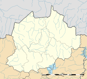
| Géolocalisation sur la carte : Cameroun
Géolocalisation sur la carte : Cameroun
Géolocalisation sur la carte : région du Nord-Ouest
| ||||
| modifier |
||||
Population
Lors du recensement national de 2005, Kedjom Ketinguh comptait 11 317 habitants[1].
On y parle le babanki, une langue bantoïde des Grassfields[3].
Notes et références
Annexes
Wikiwand in your browser!
Seamless Wikipedia browsing. On steroids.
Every time you click a link to Wikipedia, Wiktionary or Wikiquote in your browser's search results, it will show the modern Wikiwand interface.
Wikiwand extension is a five stars, simple, with minimum permission required to keep your browsing private, safe and transparent.


