Mount Tasman
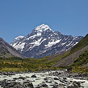
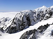
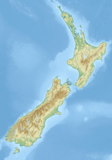
Mountain in New ZealandMount Tasman is New Zealand's second-highest mountain, rising to a height of 3,497 metres (11,473 ft). It is located in the Southern Alps of the South Island, four kilometres to the north of its larger neighbour, Aoraki / Mount Cook. Unlike Aoraki / Mount Cook, Mount Tasman sits on the South Island's Main Divide, on the border between Aoraki / Mount Cook National Park and Westland Tai Poutini National Park. It is the highest point in Westland District.
Read article
Top Questions
AI generatedMore questions
Nearby Places

Aoraki / Mount Cook
Highest mountain in New Zealand

Lendenfeld Peak
Mountain in New Zealand

Mount Vancouver (New Zealand)
Mountain in New Zealand

Dixon Peak
Peak in Aoraki / Mount Cook National Park in New Zealand

Mount Hicks (New Zealand)
Mountain in New Zealand

Mount Haast (Westland District)
Mountain in Westland District, New Zealand

Torres Peak
Mountain in New Zealand

Mount Teichelmann
Mountain in the Southern Alps, New Zealand


