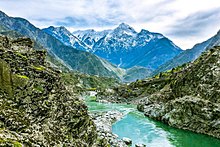
Kohistan District, Pakistan
District in Khyber Pakhtunkhwa, PakistanIndus Kohistan, also known Hazara Kohistan, is a geographical region in northern Pakistan, consisting of eastern portion of the larger Kohistan region. Formerly administered as Kohistan District within the Hazara Division of Khyber Pakhtunkhwa, it was bifurcated into two districts in 2014: Upper Kohistan and Lower Kohistan. In 2017, the Lower Kohistan District was further bifurcated and a district Kolai-Palas was established. It has an area of 7,492 square kilometres (2,893 sq mi) and a population of 472,570 according to the 1998 Census.
Read article
Top Questions
AI generatedMore questions
Nearby Places
2010 Kohistan avalanche


