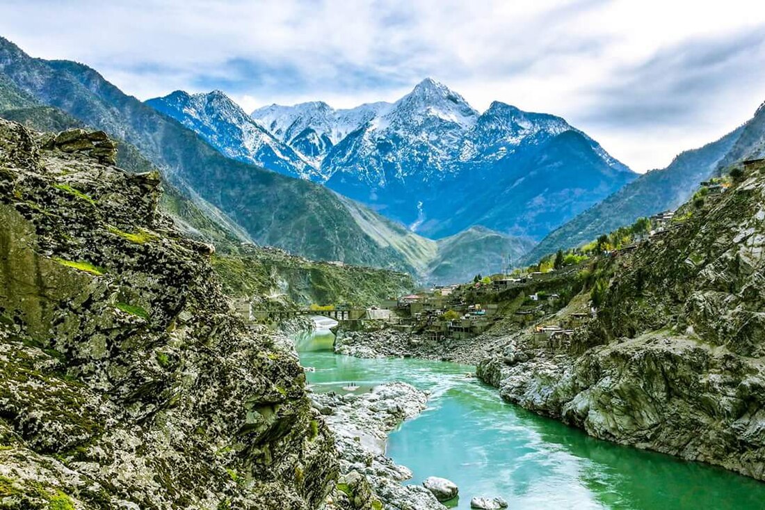
Kohistan District, Pakistan
District in Khyber Pakhtunkhwa, Pakistan From Wikipedia, the free encyclopedia
Kohistan District, also known as Indus Kohistan (Kohistani: سندھُ کوستَیں)[2][3] and Hazara Kohistan,[4] was a district within the Hazara Division of Khyber Pakhtunkhwa, Pakistan. Consisting of eastern portion of the larger Kohistan region, it was bifurcated into two districts in 2014: Upper Kohistan and Lower Kohistan. In 2017, the Lower Kohistan District was further bifurcated and a district Kolai-Palas was established.[5][6] It has an area of 7,492 square kilometres (2,893 sq mi) and a population of 472,570 according to the 1998 Census.[7]
Indus Kohistan
کوہستان | |
|---|---|
 | |
 Location of the former Kohistan District (highlighted in red) in Pakistan | |
| Coordinates: 35°15′N 73°30′E | |
| Country | Pakistan |
| Province | Khyber Pakhtunkhwa |
| Division | Hazara |
| Established | 1 October 1976-2014 |
| Headquarters | Dasu |
| Area | |
• Total | 7,492 km2 (2,893 sq mi) |
| Population (2017)[1] | |
• Total | 784,711 |
| • Density | 100/km2 (270/sq mi) |
| Time zone | UTC+5 (PST) |
Geographically, Kohistan stretched from Gilgit-Baltistan in the north to the Mansehra District in the east to the Battagram District and Shangla and Swat districts in the west.[8]
Geography
The district lies between 34° 54′ and 35° 52′ north latitudes and 72° 43′ and 73° 57′ east longitudes.[8] It was bounded by the Diamer District of Gilgit-Baltistan in the north, Manshera District in the southeast, Kaghan Valley of the Mansehra District in the southeast , Battagram District in the south and Shangla and Swat Districts in the west .[8]

Kohistan is the point of convergence for the Hindukush, Karakorum, and Himalayan mountain ranges, acting as a natural boundary delineating distinct environmental regions within the expanse of the Himalayas, Karakoram, and Hindu Kush mountain chains.[8] This uniqueness of the mountain system also results in rich flora and fauna, thus providing a habitat for unique species such as the Western Tragopan pheasant and the snow leopard.[8]
Education
The literacy rate of the district among the population aged 10 years and older is 11.1%: male 17.23% and female 2.95%. The proportion of the working or employed population to the population aged 10 years and older is 26.47%, which is 70.53% of the total labour force. Out of the total employed population, 71.60% are self-employed, 10.68% work as employees, and 17.32% are unpaid family helpers.[citation needed]
Kohistan's literacy rate is among the lowest in Pakistan and hovers around 20%.[9] It has the lowest Human Development Index of all districts in Khyber Pakhtunkhwa.
Demographics
Summarize
Perspective
| Year | Pop. | ±% p.a. |
|---|---|---|
| 1951 | 18,775 | — |
| 1961 | 54,452 | +11.24% |
| 1972 | 84,826 | +4.11% |
| 1981 | 147,635 | +6.35% |
| 1998 | 280,666 | +3.85% |
| 2017 | 784,711 | +5.56% |
| Sources:[10] | ||
At the time of the 2017 census the district had a population of 784,711, of which 424,643 were males and 360,055 females. The rural population was 706,433 (97.95%) while the urban population was 72,654 (2.05%). The literacy rate was 76.20% - the male literacy rate was 86.40% while the female literacy rate was 65.76%. 3,172 (0.24%) people in the district were from religious minorities, mainly Christians.[11]
At the time of the 2017 census, 91.96 of the population spoke Kohistani, 7.09% Pashto, 0.36% Urdu and 0.63% Punjabi as their first language. 2.07% of the population spoke languages classified as 'Others', mainly Kohistani languages.[11]
The major language of the area is Kohistani, which in the 1981 census, was the mother tongue of 92% of households.[12] The variety spoken in the District of Kohistan has formed the basis of a literary language.[13] It is very close to the Dardic Language of Kohistan: the two share 86% of their basic vocabulary.[14]
Other languages, such as Pashto, Urdu and Punjabi, are found more in urban than rural areas.
See also
References
Wikiwand - on
Seamless Wikipedia browsing. On steroids.
